MyTopo
Manchester Kansas US Topo Map
Couldn't load pickup availability
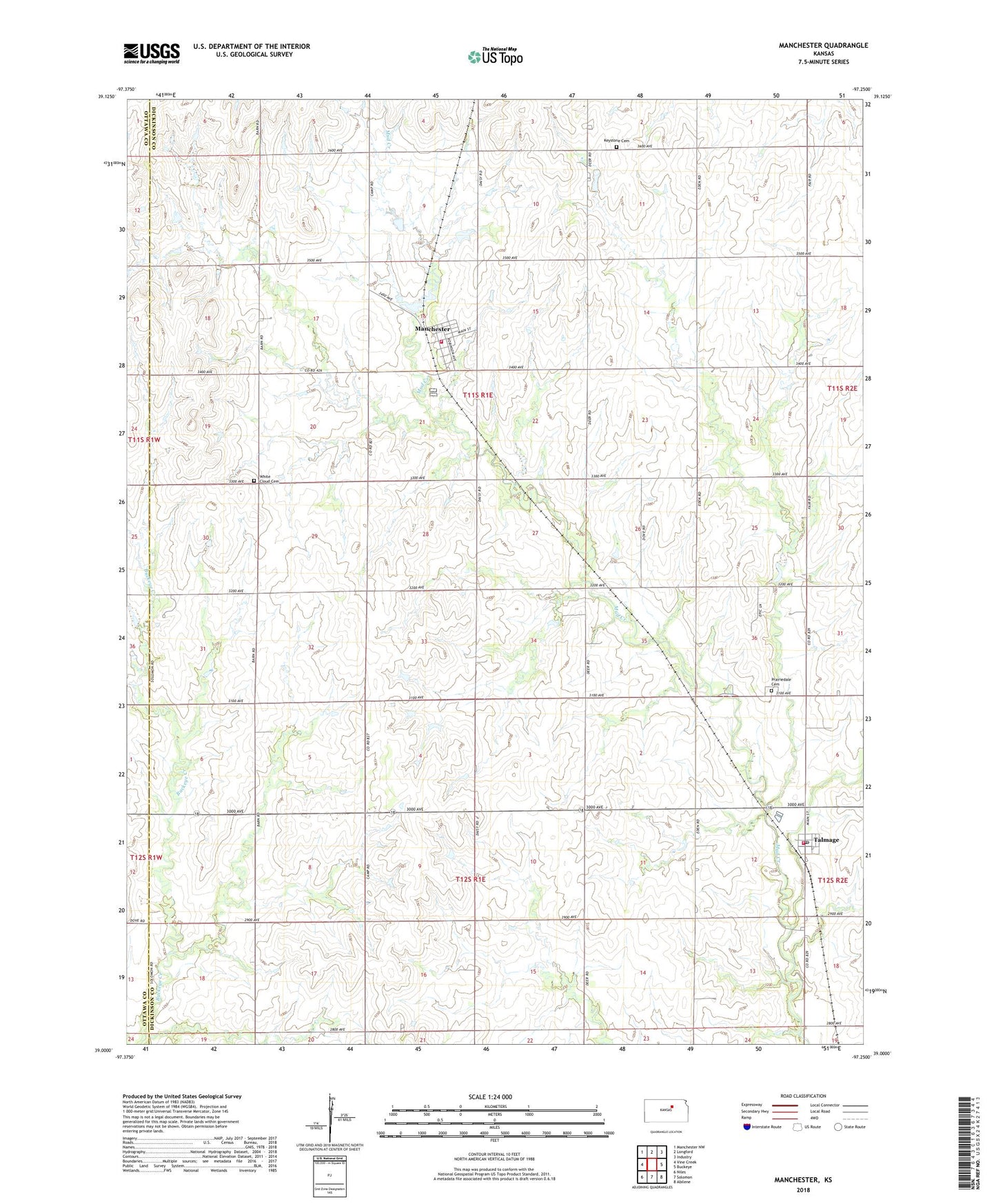
2022 topographic map quadrangle Manchester in the state of Kansas. Scale: 1:24000. Based on the newly updated USGS 7.5' US Topo map series, this map is in the following counties: Dickinson, Ottawa. The map contains contour data, water features, and other items you are used to seeing on USGS maps, but also has updated roads and other features. This is the next generation of topographic maps. Printed on high-quality waterproof paper with UV fade-resistant inks.
Quads adjacent to this one:
West: Vine Creek
Northwest: Manchester NW
North: Longford
Northeast: Industry
East: Buckeye
Southeast: Abilene
South: Solomon
Southwest: Niles
This map covers the same area as the classic USGS quad with code o39097a3.
Contains the following named places: City of Manchester, Keystone, Keystone Cemetery, Longford Rural Fire District 1 Talmadge Station 6, Manchester, Manchester Fire Department, Manchester Wastewater Plant, Poplar Hill, Prairiedale Cemetery, Talmage, Talmage Census Designated Place, Talmage Post Office, Talmage United Methodist Church, Talmage Wastewater Plant, Team Marketing Alliance Grain Elevator Number 46, The Lord's Chapel, Township of Flora, Township of Willowdale, White Cloud Cemetery, ZIP Code: 67482