MyTopo
Burdick Kansas US Topo Map
Couldn't load pickup availability
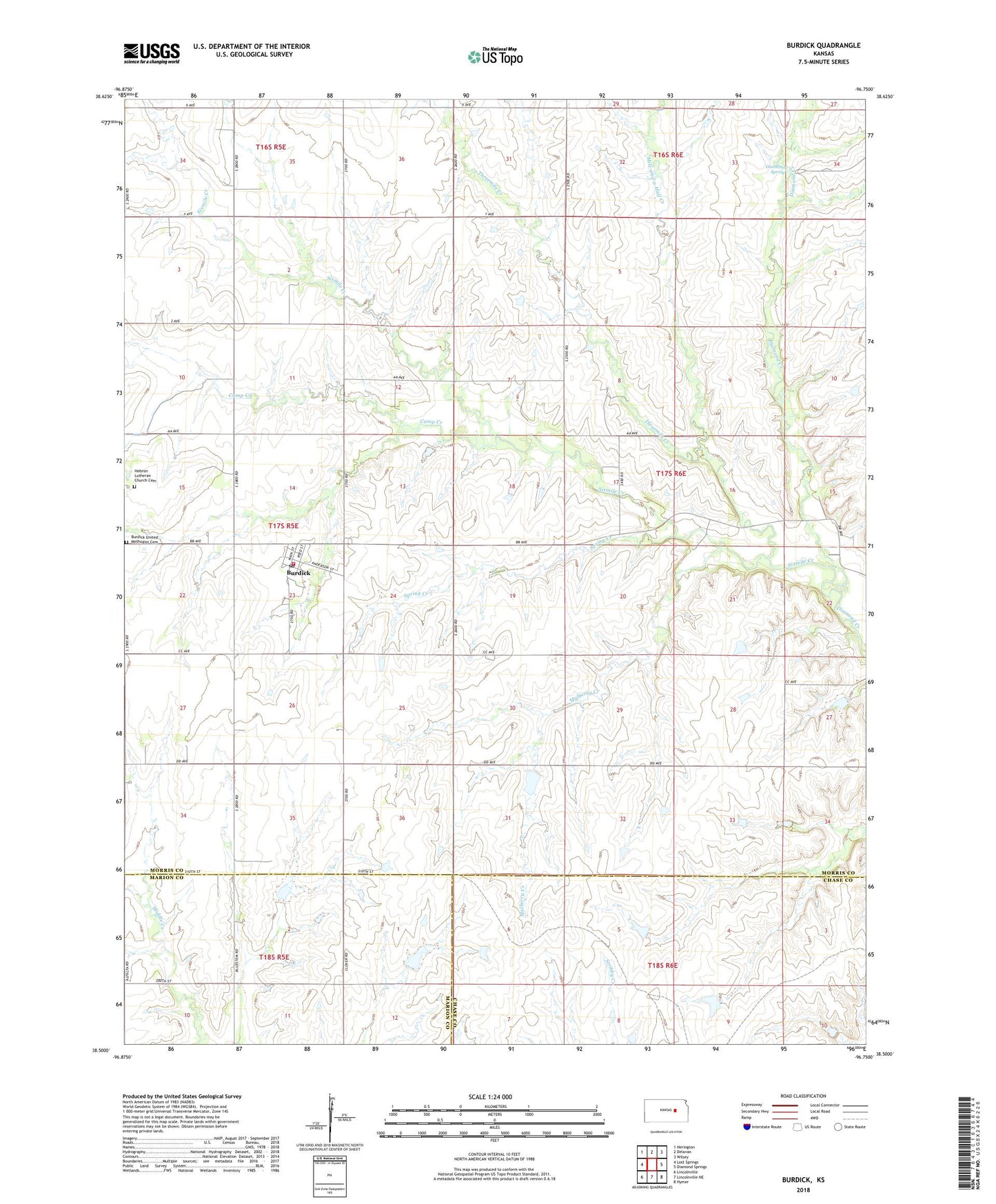
2022 topographic map quadrangle Burdick in the state of Kansas. Scale: 1:24000. Based on the newly updated USGS 7.5' US Topo map series, this map is in the following counties: Morris, Chase, Marion. The map contains contour data, water features, and other items you are used to seeing on USGS maps, but also has updated roads and other features. This is the next generation of topographic maps. Printed on high-quality waterproof paper with UV fade-resistant inks.
Quads adjacent to this one:
West: Lost Springs
Northwest: Herington
North: Delavan
Northeast: Wilsey
East: Diamond Springs
Southeast: Hymer
South: Lincolnville NE
Southwest: Lincolnville
This map covers the same area as the classic USGS quad with code o38096e7.
Contains the following named places: Burdick, Burdick and Diamond Valley Township Fire Department, Burdick Census Designated Place, Burdick Post Office, Burdick United Methodist Cemetery, Burdick United Methodist Church, Camp Creek, Diamond Spring, Hebron Lutheran Church, Hebron Lutheran Church Cemetery, Mile-and-a-Half Creek, Mulberry Creek, Sixmile Creek, Spring Creek, Threemile Creek, Township 8, ZIP Code: 66838