MyTopo
Lincolnville Kansas US Topo Map
Couldn't load pickup availability
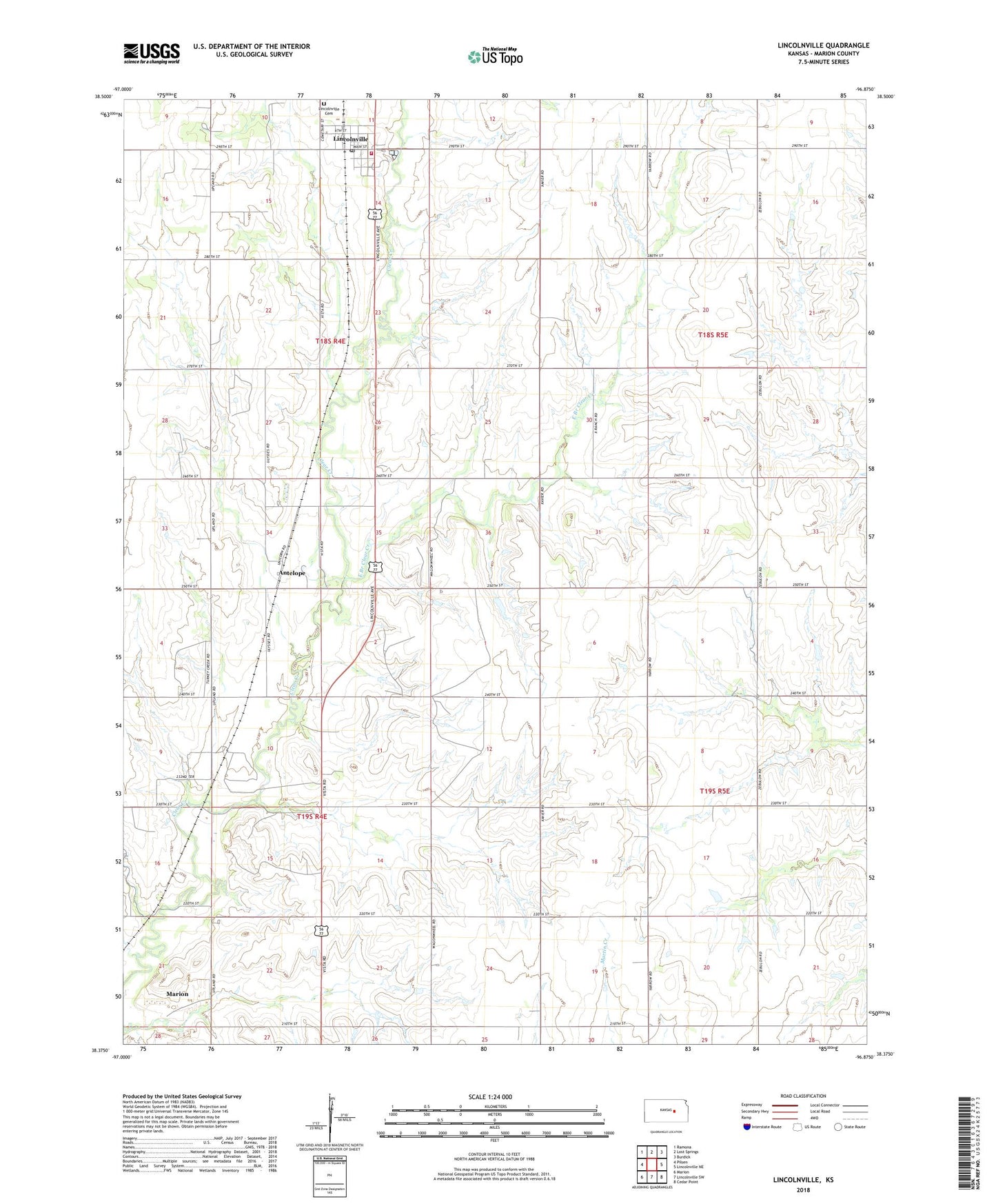
2022 topographic map quadrangle Lincolnville in the state of Kansas. Scale: 1:24000. Based on the newly updated USGS 7.5' US Topo map series, this map is in the following counties: Marion. The map contains contour data, water features, and other items you are used to seeing on USGS maps, but also has updated roads and other features. This is the next generation of topographic maps. Printed on high-quality waterproof paper with UV fade-resistant inks.
Quads adjacent to this one:
West: Pilsen
Northwest: Ramona
North: Lost Springs
Northeast: Burdick
East: Lincolnville NE
Southeast: Cedar Point
South: Lincolnville SW
Southwest: Marion
This map covers the same area as the classic USGS quad with code o38096d8.
Contains the following named places: Agricultural Producers Grain Elevator Number 6, Antelope, City of Lincolnville, East Branch Clear Creek, East Creek School, Kleinhammer School, Lincolnville, Lincolnville Cemetery, Lincolnville Community Center, Lincolnville Post Office, Lincolnville United Methodist Church, Lincolnville Wastewater Plant, Lost Creek Oil and Gas Field, Marion County Fire District 5 Lincolnville Fire Department, Oliver School, Pleasant View School, Quarry School, Saint John Lutheran Church, Township of Clear Creek, Youngstown, Youngstown School, Youngtown Church, ZIP Code: 66858