MyTopo
Caldwell Kansas US Topo Map
Couldn't load pickup availability
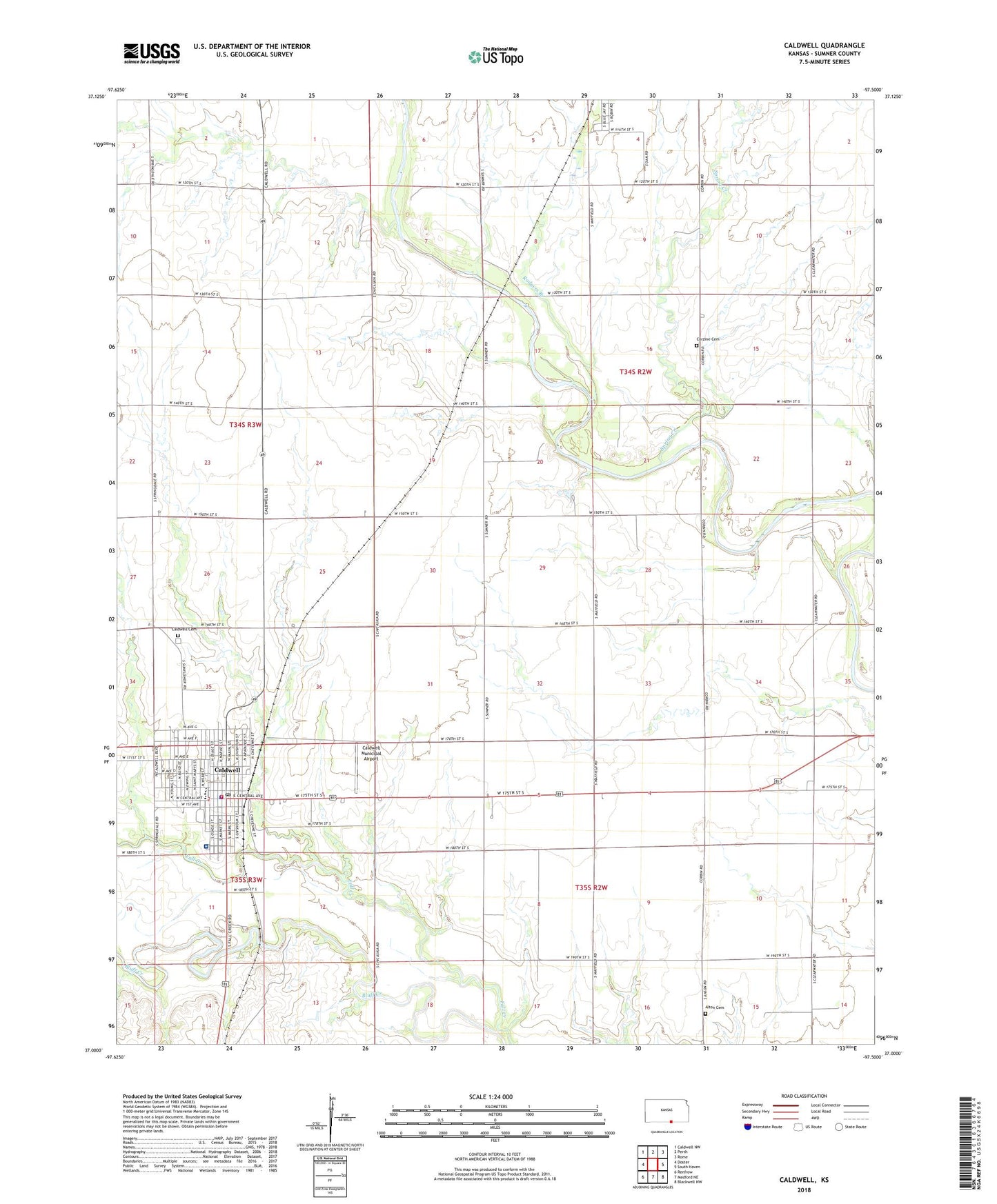
2022 topographic map quadrangle Caldwell in the state of Kansas. Scale: 1:24000. Based on the newly updated USGS 7.5' US Topo map series, this map is in the following counties: Sumner. The map contains contour data, water features, and other items you are used to seeing on USGS maps, but also has updated roads and other features. This is the next generation of topographic maps. Printed on high-quality waterproof paper with UV fade-resistant inks.
Quads adjacent to this one:
West: Doster
Northwest: Caldwell NW
North: Perth
Northeast: Rome
East: South Haven
Southeast: Blackwell NW
South: Medford NE
Southwest: Renfrow
This map covers the same area as the classic USGS quad with code o37097a5.
Contains the following named places: Alton Cemetery, Assembly of God Church, Border Queen Museum, Caldwell, Caldwell Cemetery, Caldwell Elementary School, Caldwell Fire Department, Caldwell High School, Caldwell Middle / High School, Caldwell Municipal Airport, Caldwell Police Department, Caldwell Post Office, Caldwell Public Library, Caldwell United Methodist Church, Central Christian Church, Cherokee Strip Center, City of Caldwell, Cobin United Methodist Church, Corzine Cemetery, First Baptist Church, First Church of God, First Presbyterian Church, Rodgers Branch, Saint Martin's Catholic Church, Soveriegn Grace Baptist Church, Spring Creek, Sumner County Fairgrounds, Sumner County Hospital, Township of Falls