MyTopo
Perth Kansas US Topo Map
Couldn't load pickup availability
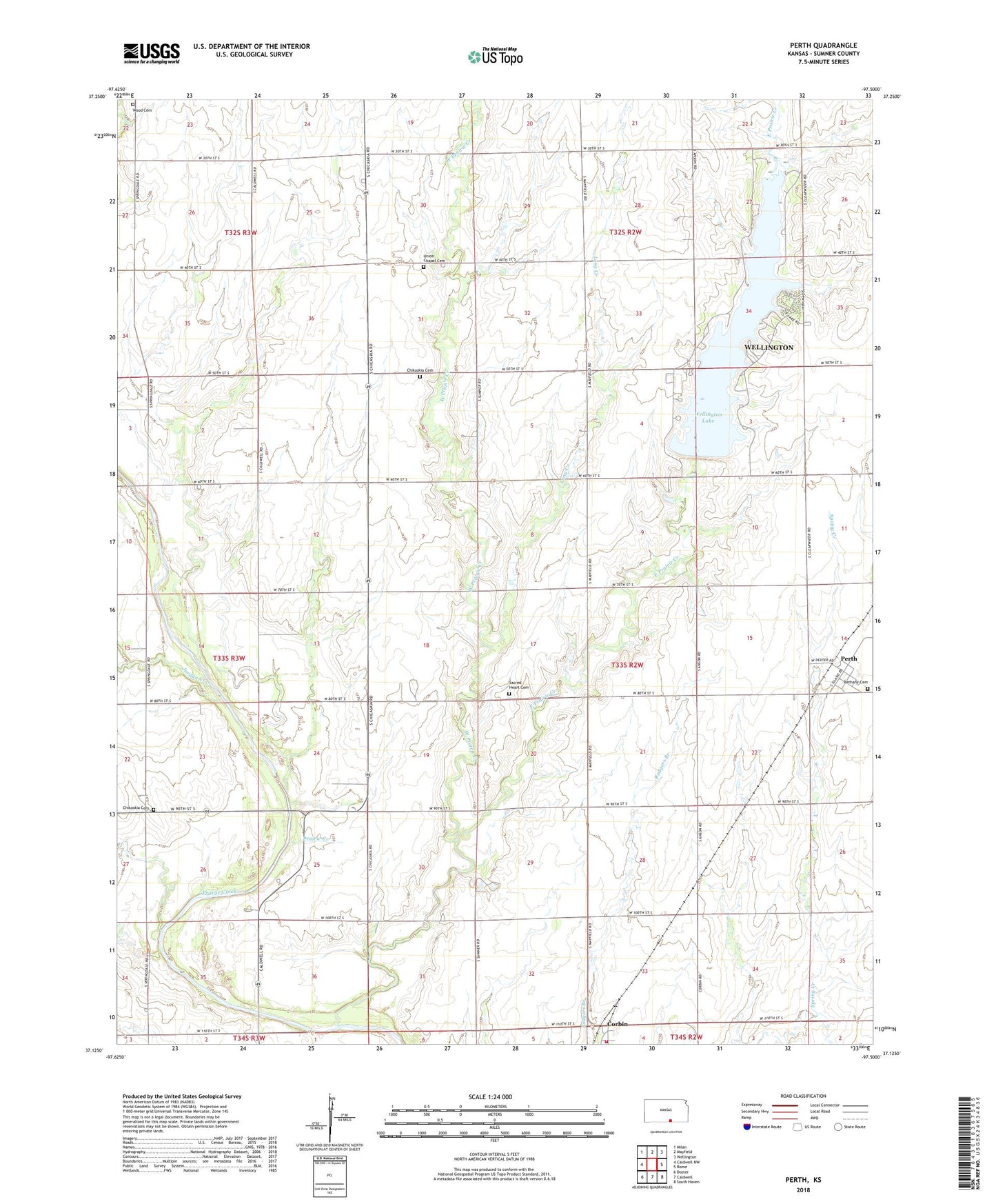
2022 topographic map quadrangle Perth in the state of Kansas. Scale: 1:24000. Based on the newly updated USGS 7.5' US Topo map series, this map is in the following counties: Sumner. The map contains contour data, water features, and other items you are used to seeing on USGS maps, but also has updated roads and other features. This is the next generation of topographic maps. Printed on high-quality waterproof paper with UV fade-resistant inks.
Quads adjacent to this one:
West: Caldwell NW
Northwest: Milan
North: Mayfield
Northeast: Wellington
East: Rome
Southeast: South Haven
South: Caldwell
Southwest: Doster
This map covers the same area as the classic USGS quad with code o37097b5.
Contains the following named places: Bethany Cemetery, Camp Loga Vista, Chicaskia Cemetery, Chikaskia, Chikaskia Cemetery, Corbin, East Prairie Creek, Jordan Creek, Long Creek, Orie, Perth, Prairie Creek, Sacred Heart Cemetery, Sumner County Fire District 5 Caldwell, Township of Downs, Union Chapel Cemetery, Wellington City Dam, Wellington City Park, Wellington Lake, West Prairie Creek, Wood Cemetery