MyTopo
Canton Kansas US Topo Map
Couldn't load pickup availability
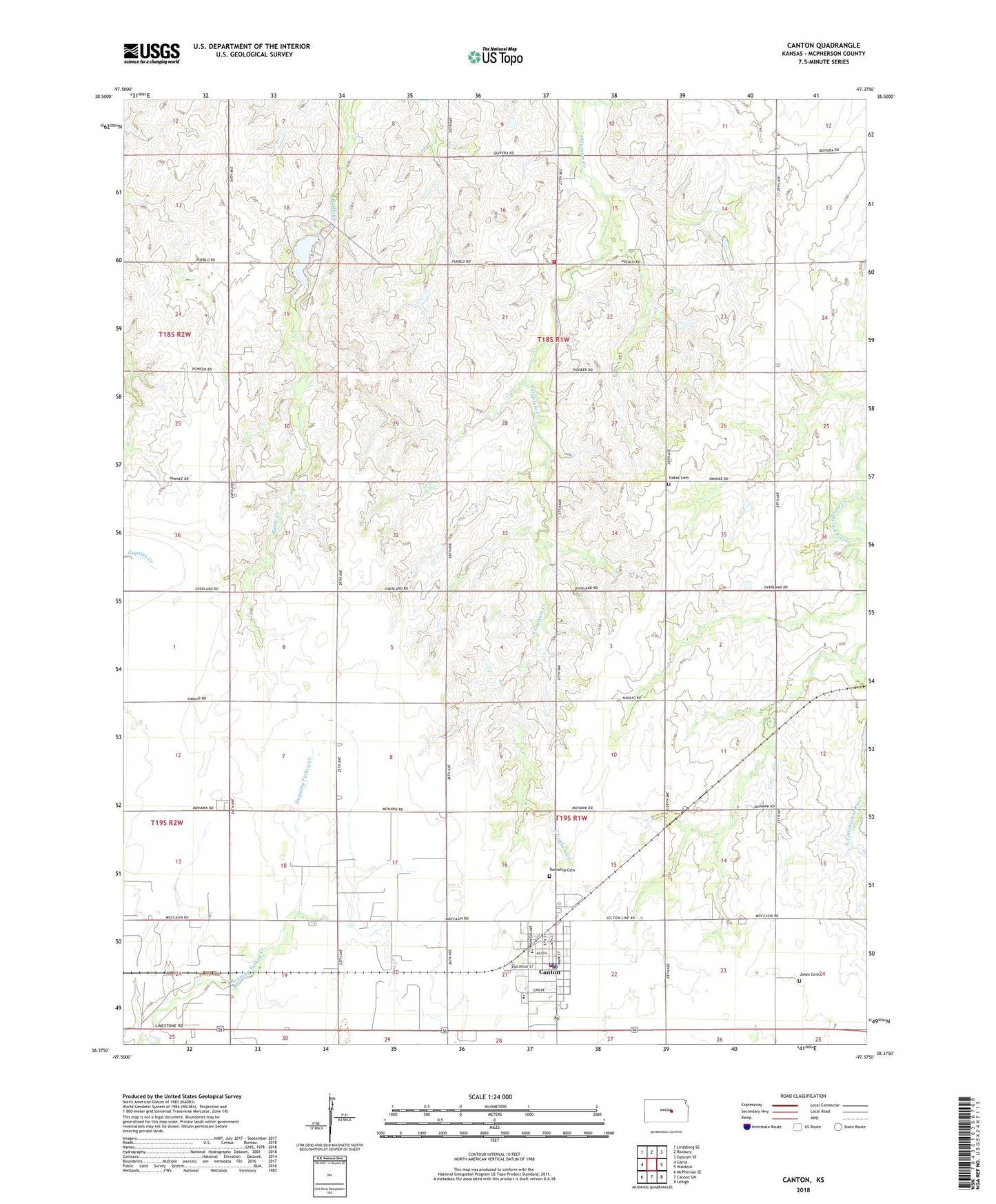
2022 topographic map quadrangle Canton in the state of Kansas. Scale: 1:24000. Based on the newly updated USGS 7.5' US Topo map series, this map is in the following counties: McPherson. The map contains contour data, water features, and other items you are used to seeing on USGS maps, but also has updated roads and other features. This is the next generation of topographic maps. Printed on high-quality waterproof paper with UV fade-resistant inks.
Quads adjacent to this one:
West: Galva
Northwest: Lindsborg SE
North: Roxbury
Northeast: Gypsum SE
East: Waldeck
Southeast: Lehigh
South: Canton SW
Southwest: McPherson SE
This map covers the same area as the classic USGS quad with code o38097d4.
Contains the following named places: Canton, Canton - Galva Junior / Senior High School, Canton Ambulance Service, Canton Carnegie Township Library, Canton Christian Church, Canton City Hall, Canton North Oil Field, Canton Police Department, Canton Post Office, Canton Township Cemetery, Canton United Methodist Church, Canton-Galva Elementary School, City of Canton, First Baptist Church, Jenday Oil Field, Jones Cemetery, Maxwell State Game Refuge, McPherson County Fairgrounds, McPherson County Rural Fire District 1, McPherson County Rural Fire District 1 Station 2, McPherson County State Lake, McPherson County State Lake Dam, Oakes Cemetery, Paden Oil Field, Team Marketing Alliance Grain Elevator Number 8, Township of Battle Hill, Township of Canton, United Center Church, United Center School