MyTopo
Labette Kansas US Topo Map
Couldn't load pickup availability
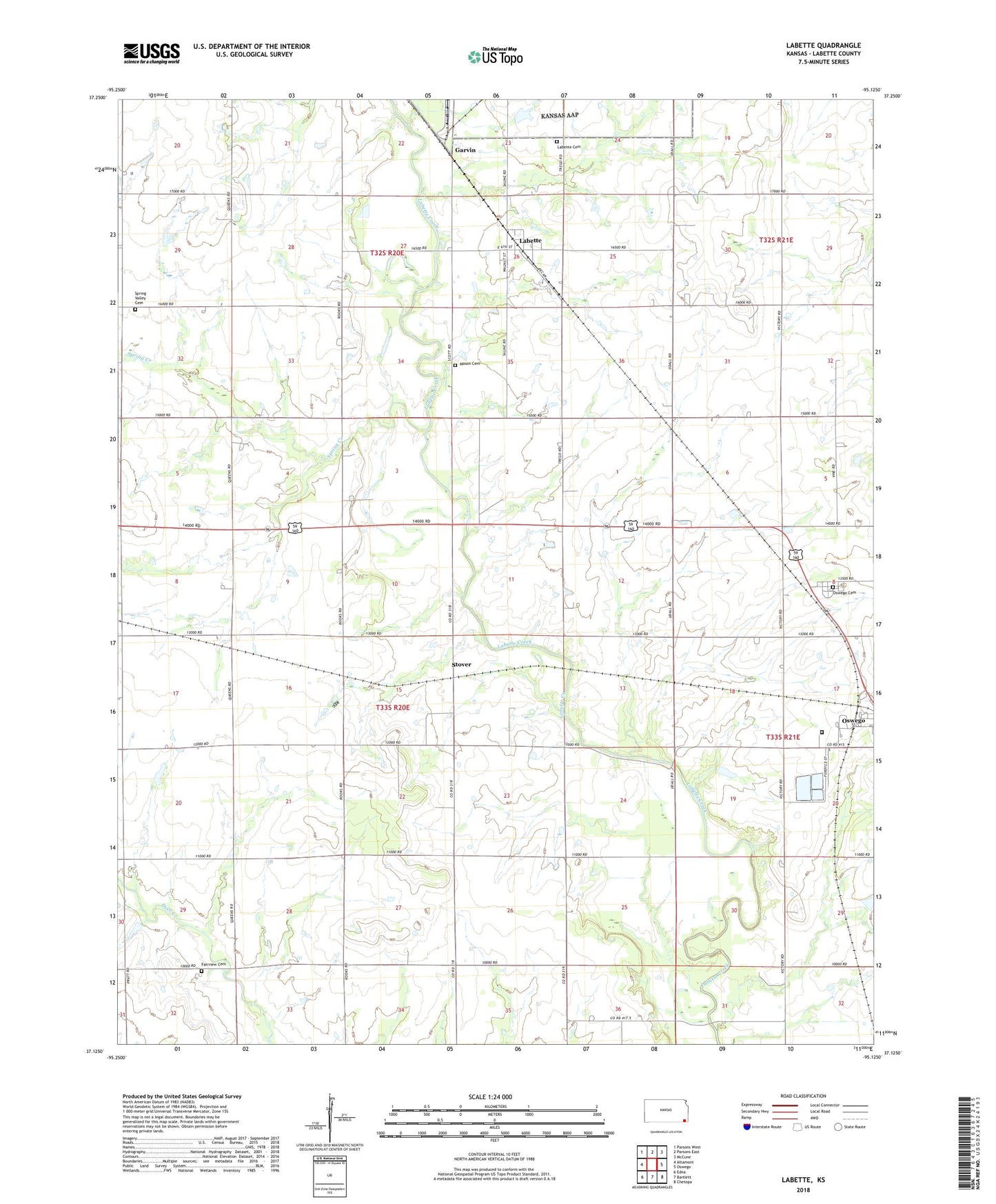
2022 topographic map quadrangle Labette in the state of Kansas. Scale: 1:24000. Based on the newly updated USGS 7.5' US Topo map series, this map is in the following counties: Labette. The map contains contour data, water features, and other items you are used to seeing on USGS maps, but also has updated roads and other features. This is the next generation of topographic maps. Printed on high-quality waterproof paper with UV fade-resistant inks.
Quads adjacent to this one:
West: Altamont
Northwest: Parsons West
North: Parsons East
Northeast: McCune
East: Oswego
Southeast: Chetopa
South: Bartlett
Southwest: Edna
This map covers the same area as the classic USGS quad with code o37095b2.
Contains the following named places: Bartlett Co - Operative Association Grain Elevator Number 5, Bowman School, Campbell School, Catalpa School, City of Labette, Dickerman School, Eclipse School, El Dorado Correctional Facility Southwest Mens Medium Oswego, Fairview Cemetery, Fairview Elementary School, Garvin, Labette, Labette Baptist Church, Labette Cemetery, Labette Correctional Conservation Camp - Womens, Maple Grove School, Mason Cemetery, Oak Grove School, Oswego Cemetery, Oswego Wastewater Plant, Rosedale School, Shiloh School, Spring Creek, Spring Valley Cemetery, Spring Valley Church, Stover, Stover School, Township of Fairview, Zion Hill Church, ZIP Code: 67356