MyTopo
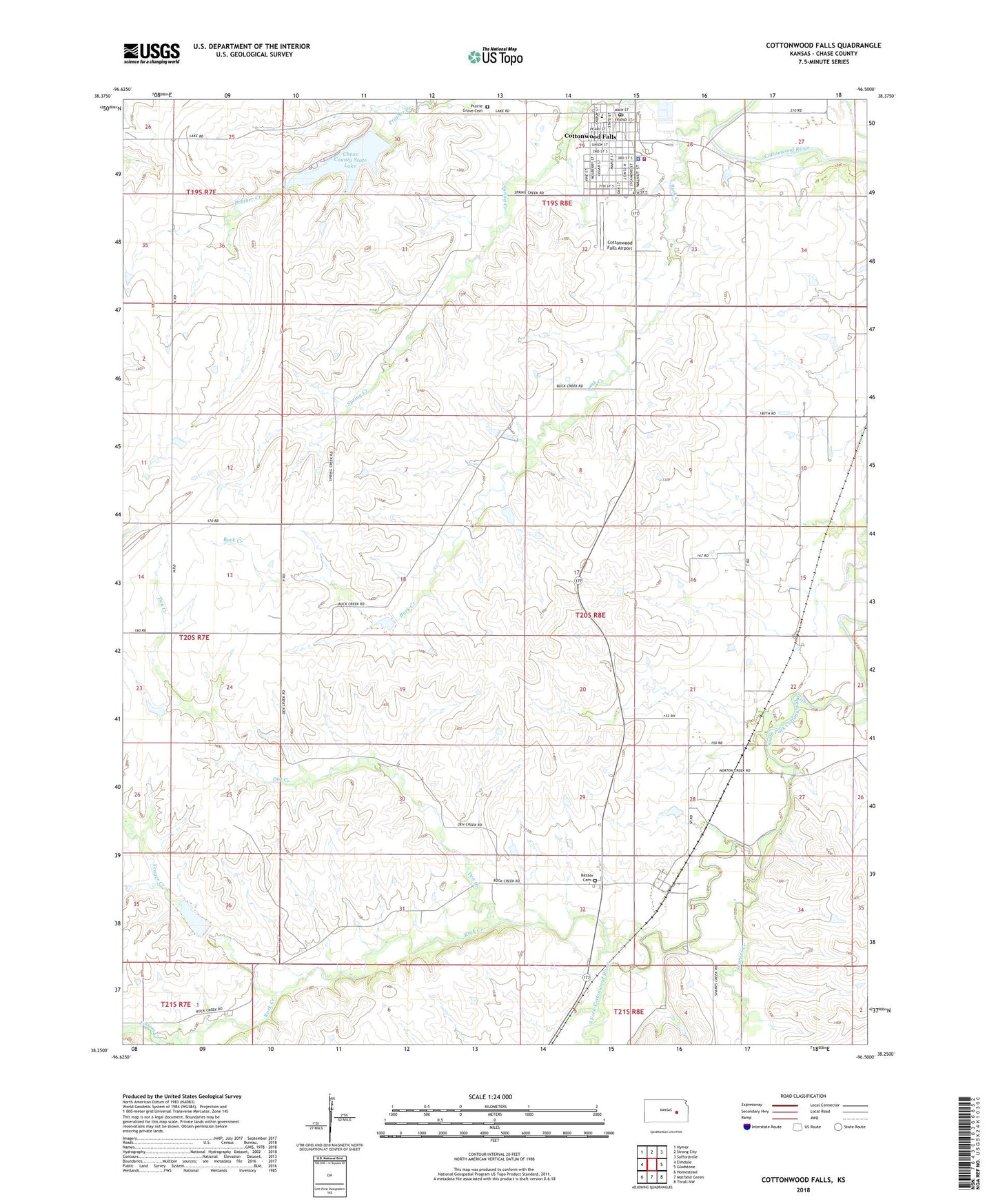
Cottonwood Falls Kansas US Topo Map
Couldn't load pickup availability
2022 topographic map quadrangle Cottonwood Falls in the state of Kansas. Scale: 1:24000. Based on the newly updated USGS 7.5' US Topo map series, this map is in the following counties: Chase. The map contains contour data, water features, and other items you are used to seeing on USGS maps, but also has updated roads and other features. This is the next generation of topographic maps. Printed on high-quality waterproof paper with UV fade-resistant inks.
Quads adjacent to this one:
West: Elmdale
Northwest: Hymer
North: Strong City
Northeast: Saffordville
East: Gladstone
Southeast: Thrall NW
South: Matfield Green
Southwest: Homestead
This map covers the same area as the classic USGS quad with code o38096c5.
Contains the following named places: Bazaar, Bazaar Cemetery, Bazaar United Methodist Church, Buck Creek, Burnley Memorial Library, Chase County, Chase County Chamber of Commerce, Chase County Courthouse, Chase County Emergency Medical Services, Chase County Fire Department, Chase County Health Department, Chase County Historical Society Library, Chase County Historical Society Museum, Chase County Jail, Chase County Junior / Senior High School, Chase County Senior Center, Chase County Sheriff's Office, Chase County State Lake, Chase County State Lake Dam, Chase State Fishing Lake and Wildlife Area, City of Cottonwood Falls, Cottonwood Falls, Cottonwood Falls Airport, Cottonwood Falls City Hall, Cottonwood Falls Post Office, Cottonwood Falls United Methodist Church, Cottonwood Falls Wastewater Treatment Facility, Den Creek, First Baptist Church, First Presbyterian Church, Flint Hills Community Church, Prairie Grove Cemetery, Rock Creek, Roniger Memorial Museum, Sharpes Creek, Swope Park, Township of Bazaar, Township of Falls, Yeager Creek, ZIP Code: 66845