MyTopo
Dorrance NE Kansas US Topo Map
Couldn't load pickup availability
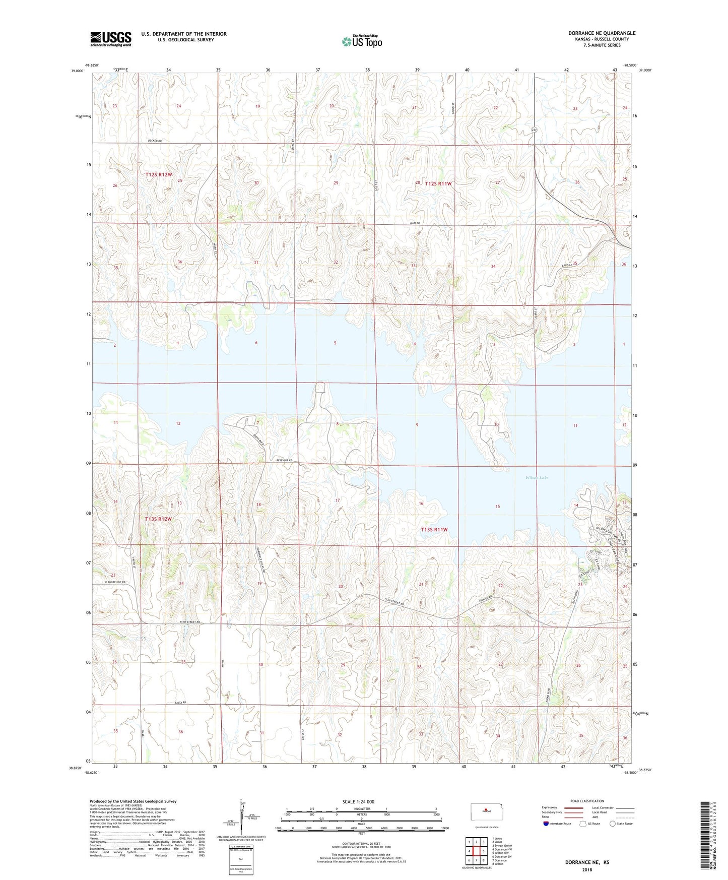
2022 topographic map quadrangle Dorrance NE in the state of Kansas. Scale: 1:24000. Based on the newly updated USGS 7.5' US Topo map series, this map is in the following counties: Russell. The map contains contour data, water features, and other items you are used to seeing on USGS maps, but also has updated roads and other features. This is the next generation of topographic maps. Printed on high-quality waterproof paper with UV fade-resistant inks.
Quads adjacent to this one:
West: Dorrance NW
Northwest: Luray
North: Lucas
Northeast: Sylvan Grove
East: Wilson NW
Southeast: Wilson
South: Dorrance
Southwest: Dorrance SW
This map covers the same area as the classic USGS quad with code o38098h5.
Contains the following named places: Biays, Hell Creek, Lucas Park Recreation Area, Minooka Park Recreation Area, Wilson Lake, Wilson State Park, Wilson State Park Big Bluestem Campground, Wilson State Park Buffalograss Campground, Wilson State Park Foxtail Campground, Wilson State Park Grama Campground, Wilson State Park Hell Creek Boat Ramp, Wilson State Park Little Bluestem Campground, Wilson State Park Lovegrass Campground, Wilson State Park Rangers Office, Wilson State Park Side Oats Campground, Wilson State Park Switchgrass Campground, Wilson State Park Wheatgrass Campground