MyTopo
Dorrance Kansas US Topo Map
Couldn't load pickup availability
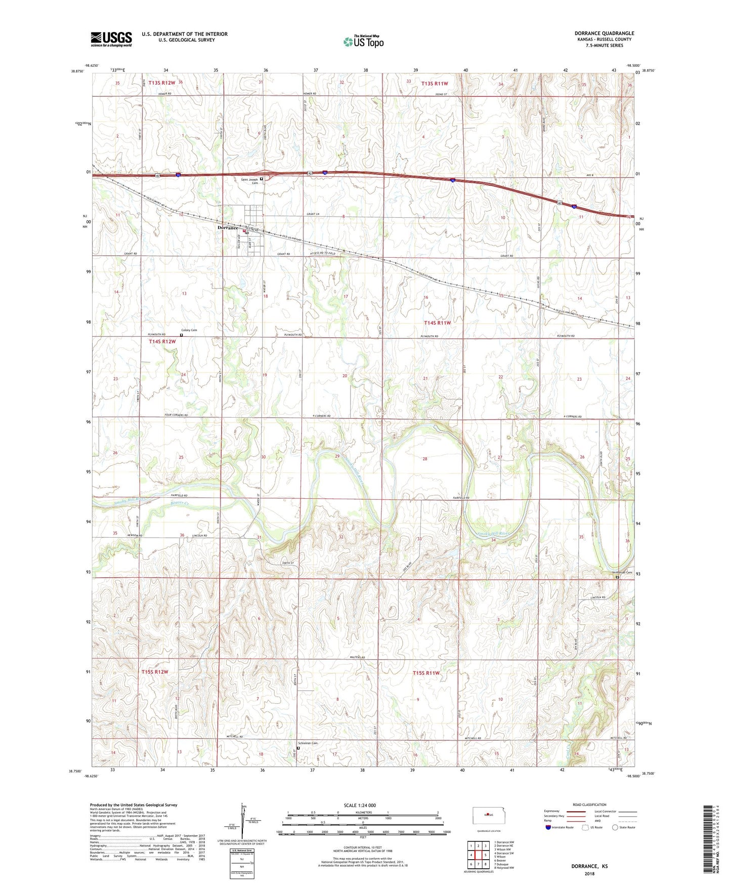
2022 topographic map quadrangle Dorrance in the state of Kansas. Scale: 1:24000. Based on the newly updated USGS 7.5' US Topo map series, this map is in the following counties: Russell. The map contains contour data, water features, and other items you are used to seeing on USGS maps, but also has updated roads and other features. This is the next generation of topographic maps. Printed on high-quality waterproof paper with UV fade-resistant inks.
Quads adjacent to this one:
West: Dorrance SW
Northwest: Dorrance NW
North: Dorrance NE
Northeast: Wilson NW
East: Wilson
Southeast: Holyrood NW
South: Dubuque
Southwest: Beaver
This map covers the same area as the classic USGS quad with code o38098g5.
Contains the following named places: Beaver Creek, City of Dorrance, Cliff School, Colony Cemetery, Dorrance, Dorrance Fire Department, Dorrance Historical Society Museum, Dorrance Post Office, Dorrance Wastewater Plant, First Lutheran Church, Immanuel Cemetery, Saint Joseph Cemetery, Schreiner Cemetery, Thielen Airport, Township of Plymouth, ZIP Code: 67634