MyTopo
Wilson NW Kansas US Topo Map
Couldn't load pickup availability
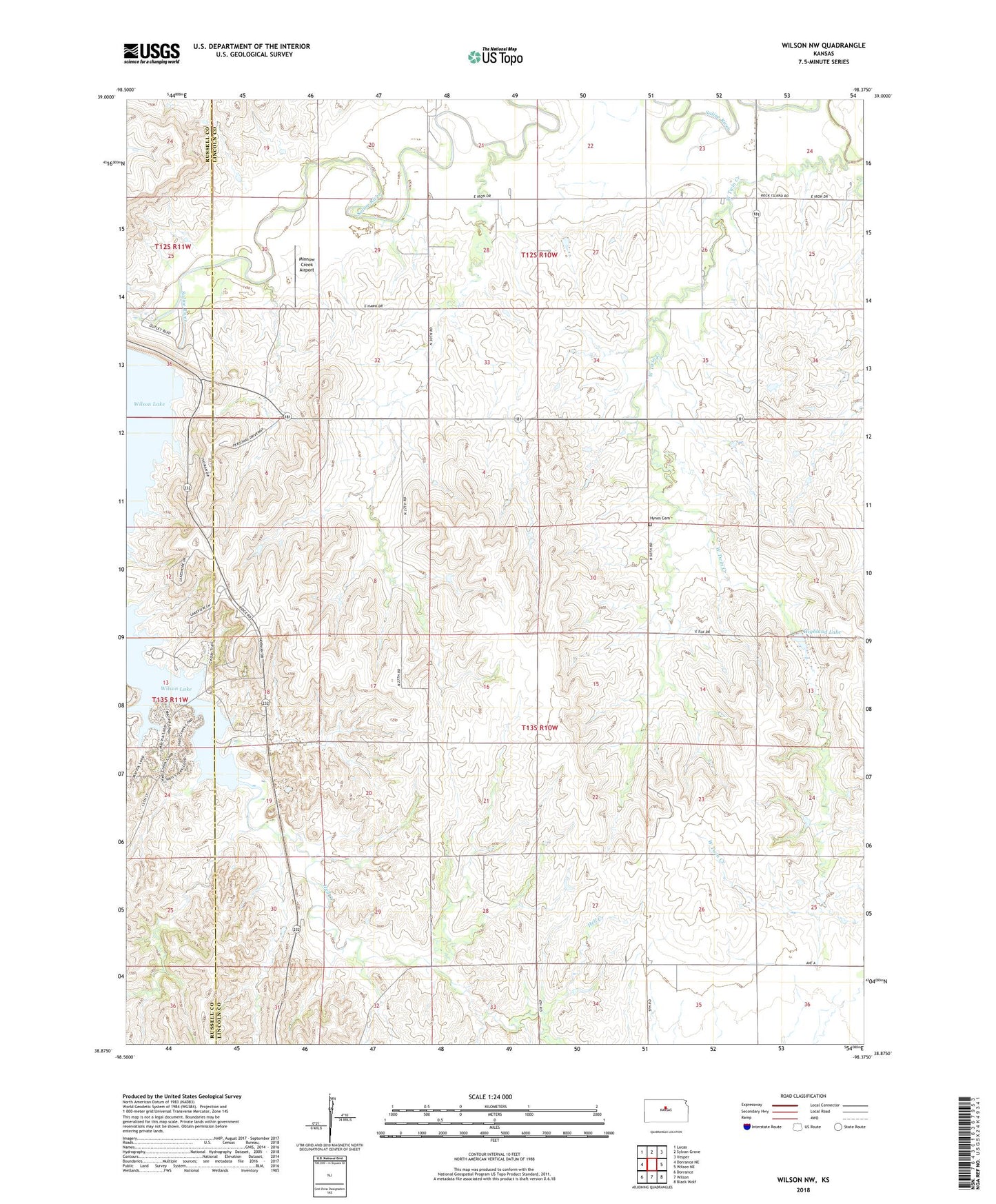
2022 topographic map quadrangle Wilson NW in the state of Kansas. Scale: 1:24000. Based on the newly updated USGS 7.5' US Topo map series, this map is in the following counties: Lincoln, Russell. The map contains contour data, water features, and other items you are used to seeing on USGS maps, but also has updated roads and other features. This is the next generation of topographic maps. Printed on high-quality waterproof paper with UV fade-resistant inks.
Quads adjacent to this one:
West: Dorrance NE
Northwest: Lucas
North: Sylvan Grove
Northeast: Vesper
East: Wilson NE
Southeast: Black Wolf
South: Wilson
Southwest: Dorrance
This map covers the same area as the classic USGS quad with code o38098h4.
Contains the following named places: Highland Dam, Highland Lake, Hynes Cemetery, Minnow Creek Airport, Orbitello, Otoe Public Use Area, Township of Highland, West Twin Creek, Wilson Dam, Wilson State Park Coneflower Campground, Wilson State Park Dropseed Campground, Wilson State Park Goldenrod Campground, Wilson State Park Indiangrass Campground, Wilson State Park Marina, Wilson State Park Otoe Boat Ramp, Wilson State Park Sagewort Campground, Wilson State Park Sunflower Campground, Wilson State Park Yarrow Campground, Wilson State Park Yucca Campground, Wilson State Wildlife Area