MyTopo
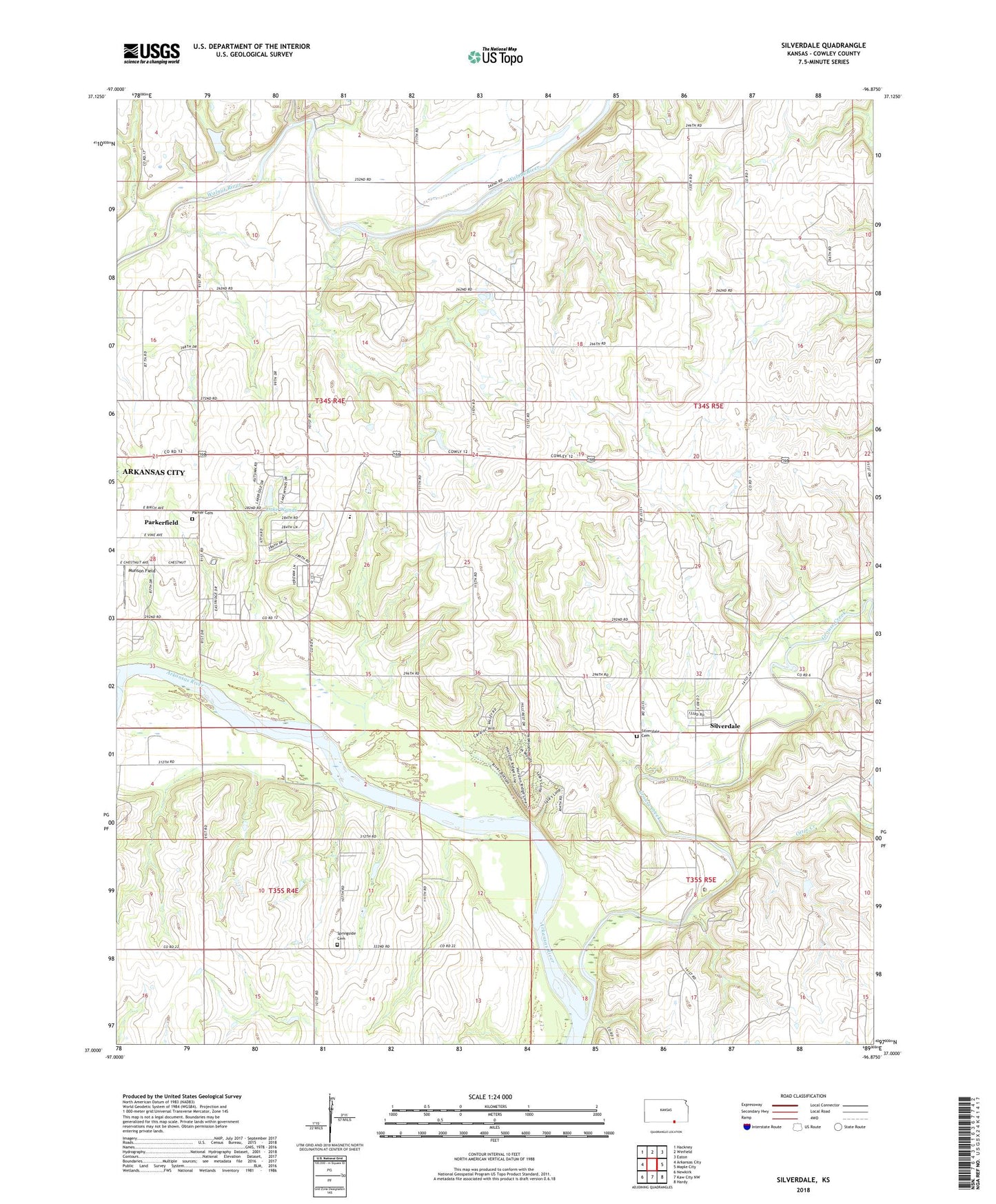
Silverdale Kansas US Topo Map
Couldn't load pickup availability
2022 topographic map quadrangle Silverdale in the state of Kansas. Scale: 1:24000. Based on the newly updated USGS 7.5' US Topo map series, this map is in the following counties: Cowley. The map contains contour data, water features, and other items you are used to seeing on USGS maps, but also has updated roads and other features. This is the next generation of topographic maps. Printed on high-quality waterproof paper with UV fade-resistant inks.
Quads adjacent to this one:
West: Arkansas City
Northwest: Hackney
North: Winfield
Northeast: Eaton
East: Maple City
Southeast: Hardy
South: Kaw City NW
Southwest: Newkirk
This map covers the same area as the classic USGS quad with code o37096a8.
Contains the following named places: Baldwin School, C - 4 Elementary School, Camp Ko-Ha-Me, Charden Farms Airport, City of Parkerfield, Coburn School, East Bolton School, Grandview Church, Grouse Creek, Grouse Creek Club, KACY - FM (Arkansas City), KSOK - FM (Arkansas City), Lake Wynds, Lake Wynds Dam, Larcom Oil Field, Louanns Mobile Home Park, Marrs Field, Munson Field, Otter Creek, Parker Cemetery, Parkerfield, Pleasant Valley, Pleasant Valley Church, Prairie View Christian Camp, Shiloh School, Silverdale, Silverdale Cemetery, Silverdale Census Designated Place, Springside Cemetery, Township of Silverdale, Walnut Bend Oil and Gas Field, ZIP Code: 67005