MyTopo
Florence Kansas US Topo Map
Couldn't load pickup availability
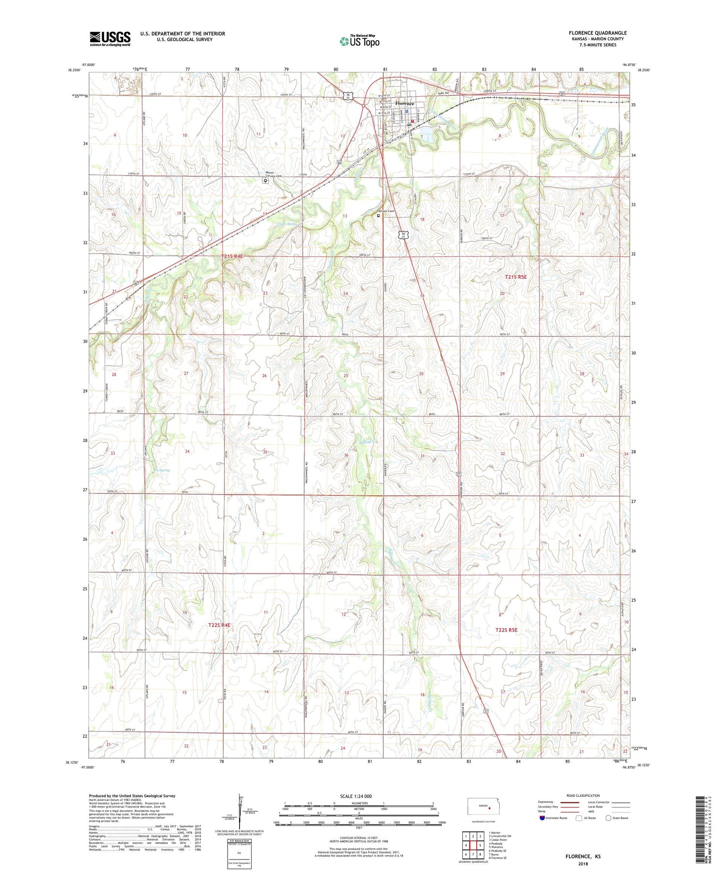
2022 topographic map quadrangle Florence in the state of Kansas. Scale: 1:24000. Based on the newly updated USGS 7.5' US Topo map series, this map is in the following counties: Marion. The map contains contour data, water features, and other items you are used to seeing on USGS maps, but also has updated roads and other features. This is the next generation of topographic maps. Printed on high-quality waterproof paper with UV fade-resistant inks.
Quads adjacent to this one:
West: Peabody
Northwest: Marion
North: Lincolnville SW
Northeast: Cedar Point
East: Wonsevu
Southeast: Florence SE
South: Burns
Southwest: Peabody SE
This map covers the same area as the classic USGS quad with code o38096b8.
Contains the following named places: Allison Cemetery, City of Florence, Coyne Spring, Doyle Creek, Fairplay School, Florence, Florence Christian Church, Florence City Hall, Florence Elementary School, Florence Fire Department, Florence Police Department, Florence Post Office, Florence Public Library, Florence United Methodist Church, Florence Wastewater Plant, Grandview Park, Hampson, Harvey House, Holy Family Catholic Church, Lee Spring, Marion County Emergency Medical Services, Moses Shane Memorial Park, Mount Calvary Cemetery, Round Top School, Santa Fe School, School Number 51, Spring Creek, Spring Valley School, Summit Church, Team Marketing Alliance Grain Elevator Number 13, Township of Doyle, Township of Fairplay, Township of Milton, Township of Summit, ZIP Code: 66851