MyTopo
Peabody Kansas US Topo Map
Couldn't load pickup availability
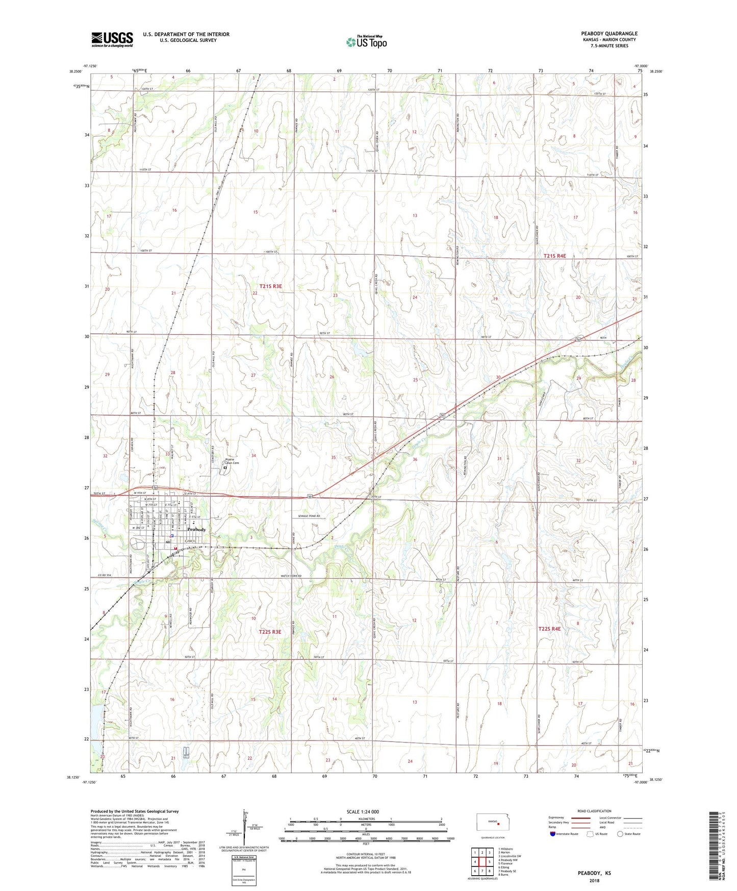
2022 topographic map quadrangle Peabody in the state of Kansas. Scale: 1:24000. Based on the newly updated USGS 7.5' US Topo map series, this map is in the following counties: Marion. The map contains contour data, water features, and other items you are used to seeing on USGS maps, but also has updated roads and other features. This is the next generation of topographic maps. Printed on high-quality waterproof paper with UV fade-resistant inks.
Quads adjacent to this one:
West: Peabody NW
Northwest: Hillsboro
North: Marion
Northeast: Lincolnville SW
East: Florence
Southeast: Burns
South: Peabody SE
Southwest: Elbing
This map covers the same area as the classic USGS quad with code o38097b1.
Contains the following named places: City of Peabody, First Baptist Church, Hardscrabble School, Honner Station, Horners, Marion County Fire District 4, Nusbaum School, Peabody, Peabody - Burns Elementary School, Peabody - Burns Junior / Senior High School, Peabody Bible Church, Peabody Christian Church, Peabody City Hall, Peabody Golf Course, Peabody Historical Museum, Peabody Police Department, Peabody Post Office, Peabody Township Library, Peabody United Methodist Church, Peabody Wastewater Plant, Pleasant Hill School, Prairie Lawn Cemetery, Saint Paul Lutheran Church, Shank School, Southview School, Spring Creek, Steinrich Church, Superior School, Team Marketing Alliance Grain Elevator Number 33, Tharp School, Townsend School, Township of Catlin, Township of Peabody, Unger Oil Field, ZIP Code: 66866