MyTopo
Wonsevu Kansas US Topo Map
Couldn't load pickup availability
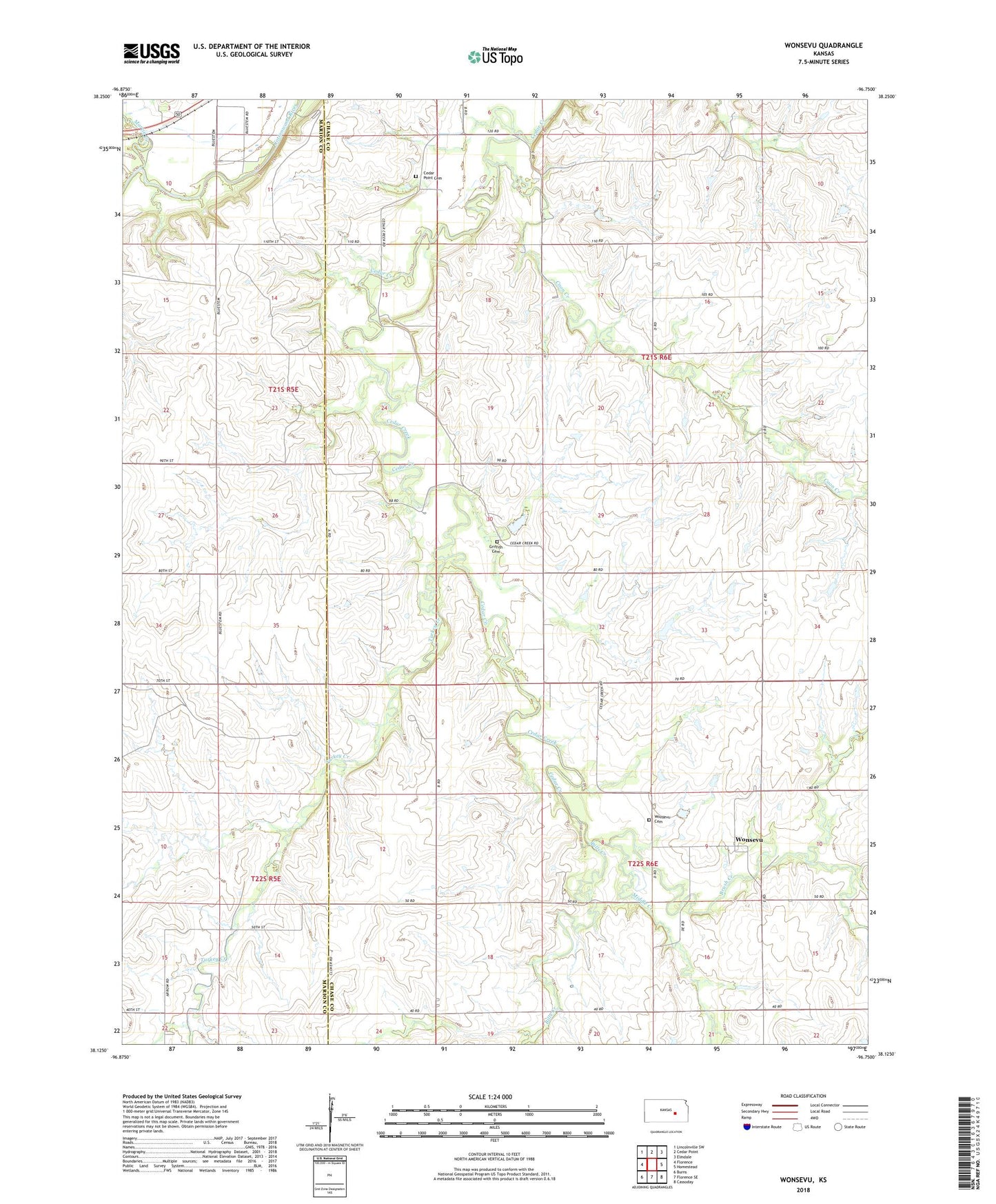
2022 topographic map quadrangle Wonsevu in the state of Kansas. Scale: 1:24000. Based on the newly updated USGS 7.5' US Topo map series, this map is in the following counties: Chase, Marion. The map contains contour data, water features, and other items you are used to seeing on USGS maps, but also has updated roads and other features. This is the next generation of topographic maps. Printed on high-quality waterproof paper with UV fade-resistant inks.
Quads adjacent to this one:
West: Florence
Northwest: Lincolnville SW
North: Cedar Point
Northeast: Elmdale
East: Homestead
Southeast: Cassoday
South: Florence SE
Southwest: Burns
This map covers the same area as the classic USGS quad with code o38096b7.
Contains the following named places: Bills Creek, Brush Creek, Cedar Point Cemetery, Cedar Point Lake, Clothier Landing Field, Coon Creek, Griffith Cemetery, Martin Creek, Middle Creek, Township of Cedar, Turkey Creek, Wonsevu, Wonsevu Cemetery