MyTopo
Fort Dodge Kansas US Topo Map
Couldn't load pickup availability
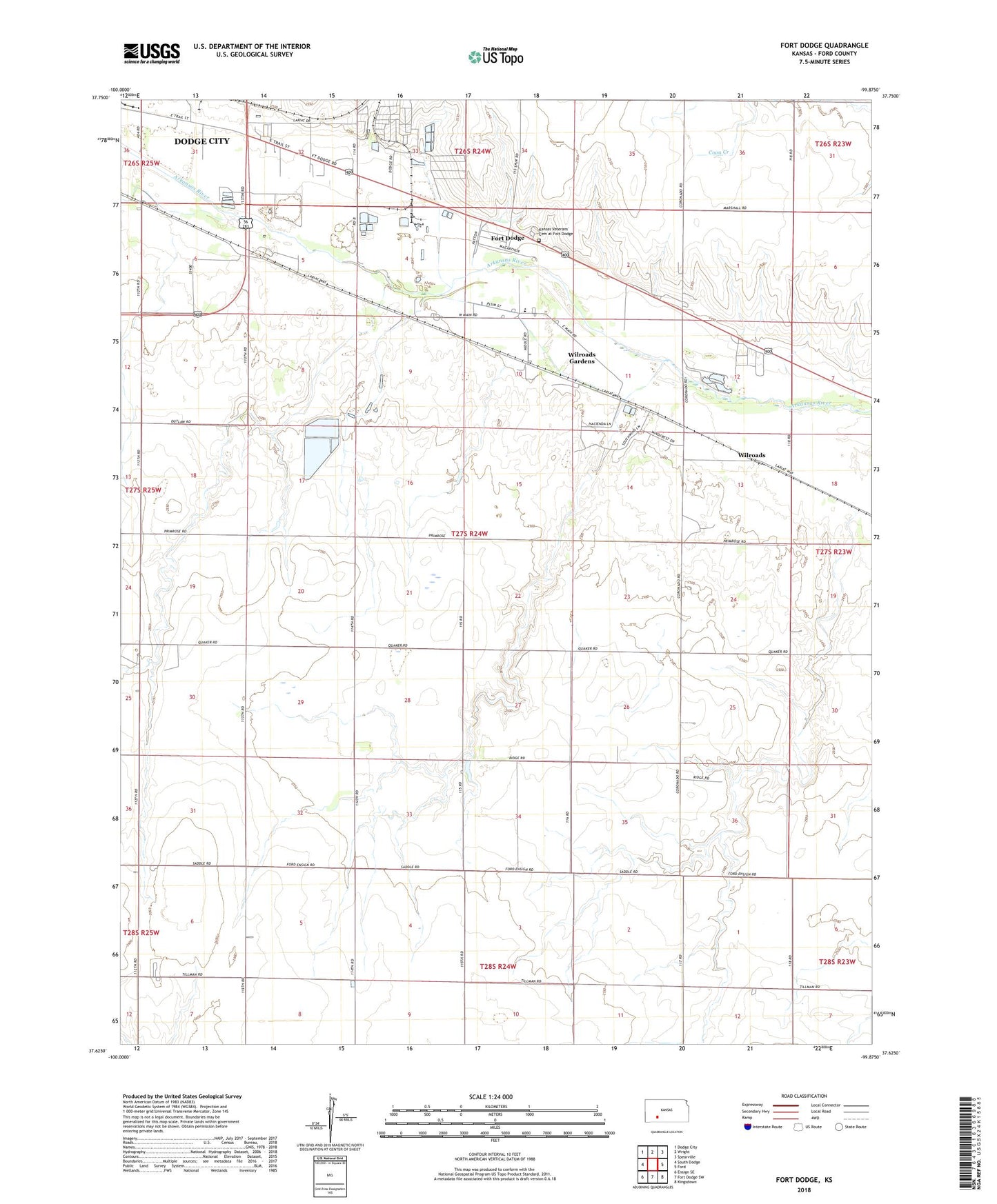
2022 topographic map quadrangle Fort Dodge in the state of Kansas. Scale: 1:24000. Based on the newly updated USGS 7.5' US Topo map series, this map is in the following counties: Ford. The map contains contour data, water features, and other items you are used to seeing on USGS maps, but also has updated roads and other features. This is the next generation of topographic maps. Printed on high-quality waterproof paper with UV fade-resistant inks.
Quads adjacent to this one:
West: South Dodge
Northwest: Dodge City
North: Wright
Northeast: Spearville
East: Ford
Southeast: Kingsdown
South: Fort Dodge SW
Southwest: Ensign SE
This map covers the same area as the classic USGS quad with code o37099f8.
Contains the following named places: D and D Mobile Home Park, Dodge City Pershing Barracks Post Hospital, Ford County, Fort Dodge, Fort Dodge Census Designated Place, Fort Dodge Chapel, Fort Dodge Eisenhower Hall, Fort Dodge Halsey Hall, Fort Dodge Kansas State Soldiers Home, Fort Dodge Library, Fort Dodge Museum, Green Acres Trailer Park, Happy Homes Park, Home for Boys Water Tank, Kansas Soldiers Home Wastewater Treatment Plant, Kansas Veterans' Cemetery at Fort Dodge, Las Brisas Mobile Home Park, Ranchwood Mobile Estates, Right Co - Operative Association Grain Elevator Number 8, Riverview Camp, Township of Enterprise, Wilroads, Wilroads Christian Church, Wilroads Feed Yard, Wilroads Gardens, Wilroads Gardens Airport, Wilroads Gardens Census Designated Place, Wilroads Gardens Elementary School, Winter Feed Yard, ZIP Code: 67843