MyTopo
South Dodge Kansas US Topo Map
Couldn't load pickup availability
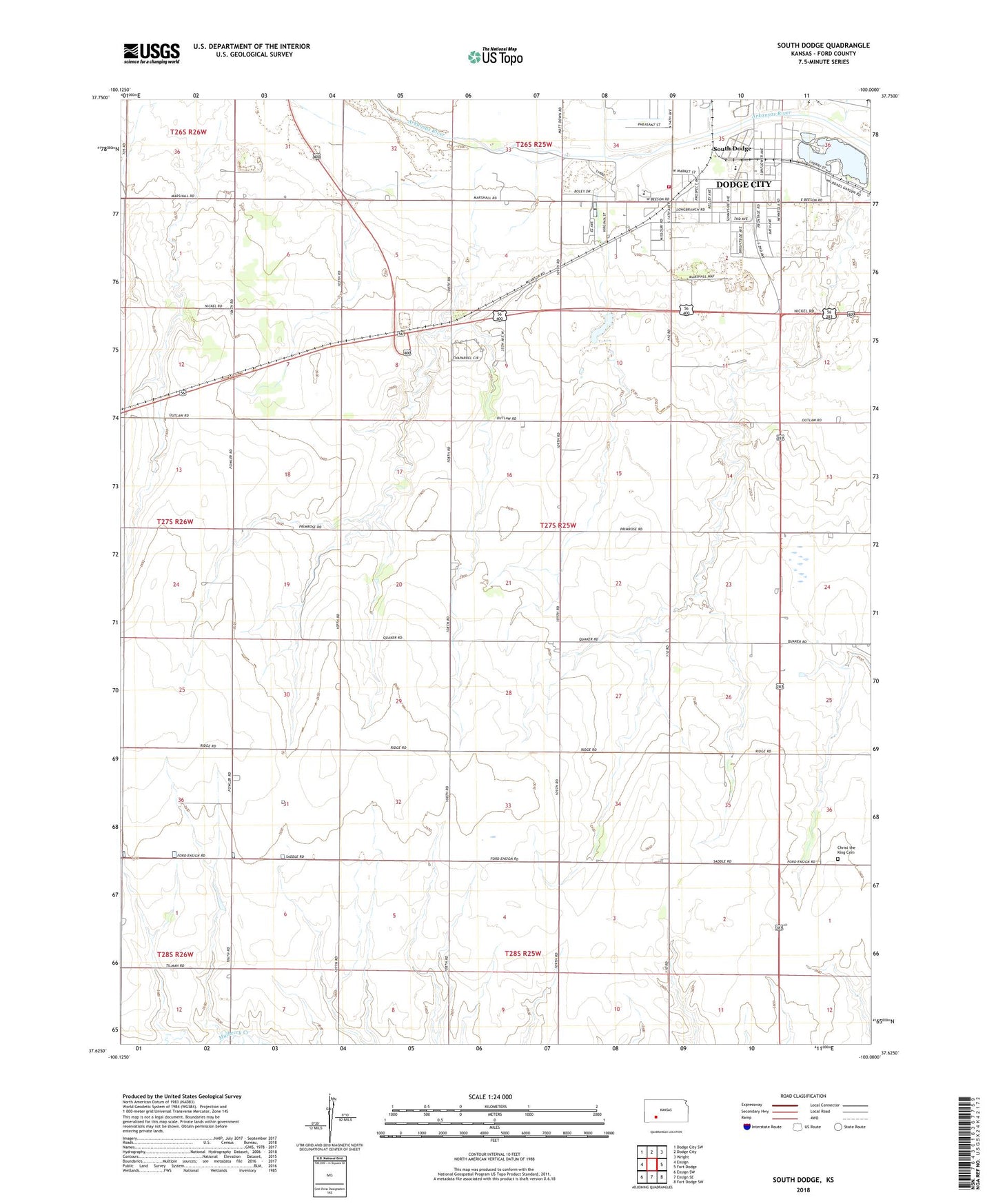
2022 topographic map quadrangle South Dodge in the state of Kansas. Scale: 1:24000. Based on the newly updated USGS 7.5' US Topo map series, this map is in the following counties: Ford. The map contains contour data, water features, and other items you are used to seeing on USGS maps, but also has updated roads and other features. This is the next generation of topographic maps. Printed on high-quality waterproof paper with UV fade-resistant inks.
Quads adjacent to this one:
West: Ensign
Northwest: Dodge City SW
North: Dodge City
Northeast: Wright
East: Fort Dodge
Southeast: Fort Dodge SW
South: Ensign SE
Southwest: Ensign SW
This map covers the same area as the classic USGS quad with code o37100f1.
Contains the following named places: Beeson Elementary School, Camelot Trailer Park, Christ the King Cemetery, Christ the King Lutheran Church, Countryside Manor Mobile Home Park, Dodge City Downs, Dodge City Fire Department Station 2, Dodge City Public Works, Dodge City Raceway Park, Dodge City Roundup Rodeo, Evergreen Trailer Court, Ford County Fairgrounds, Ford County Fire And Emergency Medical Services South Station, Fort Atkinson, Hope Church, Kansas Department of Wildlife and Parks Region 3 Headquarters, Lazy Acres Trailer Park, Palomino Ranch, Prairie Village Trailer Court, Richland Valley School, Sleepy Hollow Mobile Home Park, South Dodge, Southgate Shopping Center, Sunnyside Elementary School, Templo la Hermosa, The Village Square, Township of Richland, Victory Life Fellowship, Villa Manor Trailer Court, Watersports Mobile Home Park, Watersports Recreational Vehicle Park, Wright Park, Wright Park Zoo, ZIP Code: 67801