MyTopo
Wright Kansas US Topo Map
Couldn't load pickup availability
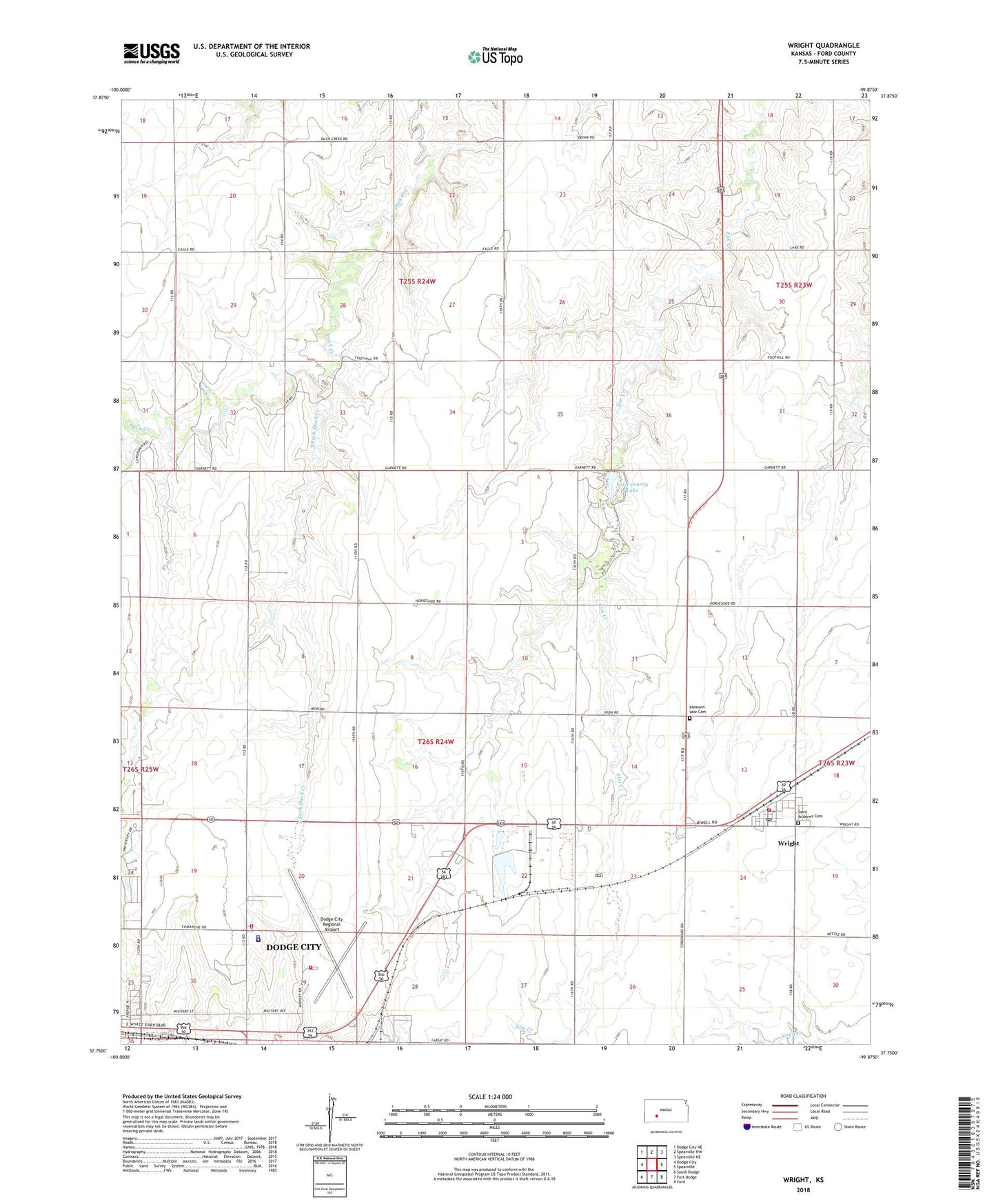
2022 topographic map quadrangle Wright in the state of Kansas. Scale: 1:24000. Based on the newly updated USGS 7.5' US Topo map series, this map is in the following counties: Ford. The map contains contour data, water features, and other items you are used to seeing on USGS maps, but also has updated roads and other features. This is the next generation of topographic maps. Printed on high-quality waterproof paper with UV fade-resistant inks.
Quads adjacent to this one:
West: Dodge City
Northwest: Dodge City NE
North: Spearville NW
Northeast: Spearville NE
East: Spearville
Southeast: Ford
South: Fort Dodge
Southwest: South Dodge
This map covers the same area as the classic USGS quad with code o37099g8.
Contains the following named places: Dodge City Airport Fire Department, Dodge City Regional Airport, Ford County Dam, Ford County Fire Department Station 8, Ford County Fire Station and Emergency Medical Services Station Airport, Ford County Jail, Ford County Jail and Sheriff's Office, Ford County Lake, Ford County Road and Bridge Department, Ford County Sheriff's Office, Ford County State Park, Grain Products Company Grain Elevator Number 1, Pleasant Vale Cemetery, Right Co - Operative Association Grain Elevator Number 1, Saint Andrew's Catholic Church, Saint Andrews Cemetery, South Fork Duck Creek, Township of Grandview, Wright, Wright Census Designated Place, Wright Elementary School, Wright Post Office, ZIP Code: 67882