MyTopo
Garnett NW Kansas US Topo Map
Couldn't load pickup availability
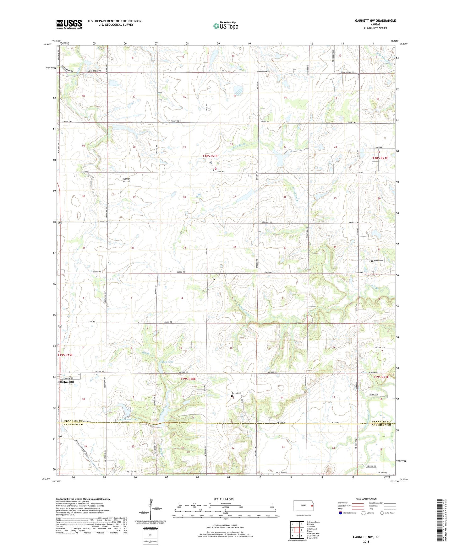
2022 topographic map quadrangle Garnett NW in the state of Kansas. Scale: 1:24000. Based on the newly updated USGS 7.5' US Topo map series, this map is in the following counties: Franklin, Anderson. The map contains contour data, water features, and other items you are used to seeing on USGS maps, but also has updated roads and other features. This is the next generation of topographic maps. Printed on high-quality waterproof paper with UV fade-resistant inks.
Quads adjacent to this one:
West: Richmond
Northwest: Ottawa South
North: Peoria
Northeast: Rantoul
East: Lane
Southeast: Garnett SE
South: Garnett East
Southwest: Garnett West
This map covers the same area as the classic USGS quad with code o38095d2.
Contains the following named places: Baker Cemetery, Berea Cemetery, Central Heights Elementary School, Central Heights High School, Central Heights Middle School, Central Heights Unified School District Office, Cochran Airport, Gilkey Lake, Mount Gilead, North Fork Sac Branch, Ohio Company, Pottawatomie Township Fire Department Station 2, Richmond Lake, South Fork Pottawatomie Creek, South Fork Sac Branch, Township of Pottawatomie, V and P Recreational Vehicle Park