MyTopo
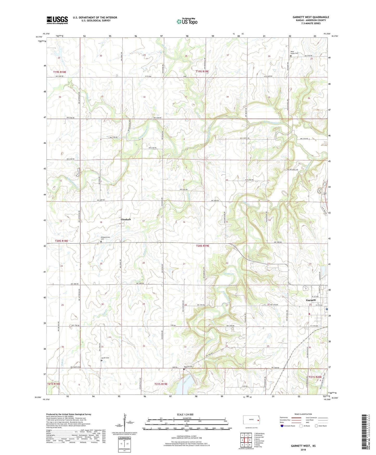
Garnett West Kansas US Topo Map
Couldn't load pickup availability
2022 topographic map quadrangle Garnett West in the state of Kansas. Scale: 1:24000. Based on the newly updated USGS 7.5' US Topo map series, this map is in the following counties: Anderson. The map contains contour data, water features, and other items you are used to seeing on USGS maps, but also has updated roads and other features. This is the next generation of topographic maps. Printed on high-quality waterproof paper with UV fade-resistant inks.
Quads adjacent to this one:
West: Harris
Northwest: Williamsburg
North: Richmond
Northeast: Garnett NW
East: Garnett East
Southeast: Bush City
South: Welda
Southwest: Westphalia
This map covers the same area as the classic USGS quad with code o38095c3.
Contains the following named places: Amish Cemetery, Anderson County Fire Department, Anderson County Hospital, Anderson County Jail, Anderson County Junior / Senior High School, Baptist Cemetery, Cedar Creek, Church of Christ, Fish Creek, Glenlock, Iantha Creek, Kingdom Hall of Jehovah's Witnesses, New Life Baptist Church, Pleasantview Cemetery, Sac Creek, Township of Jackson, Township of Putnam, Trinity Lutheran Church, Valley R Agricultural - Service Grain Elevator Number 1, West Scipio Cemetery, ZIP Code: 66032