MyTopo
Garnett SE Kansas US Topo Map
Couldn't load pickup availability
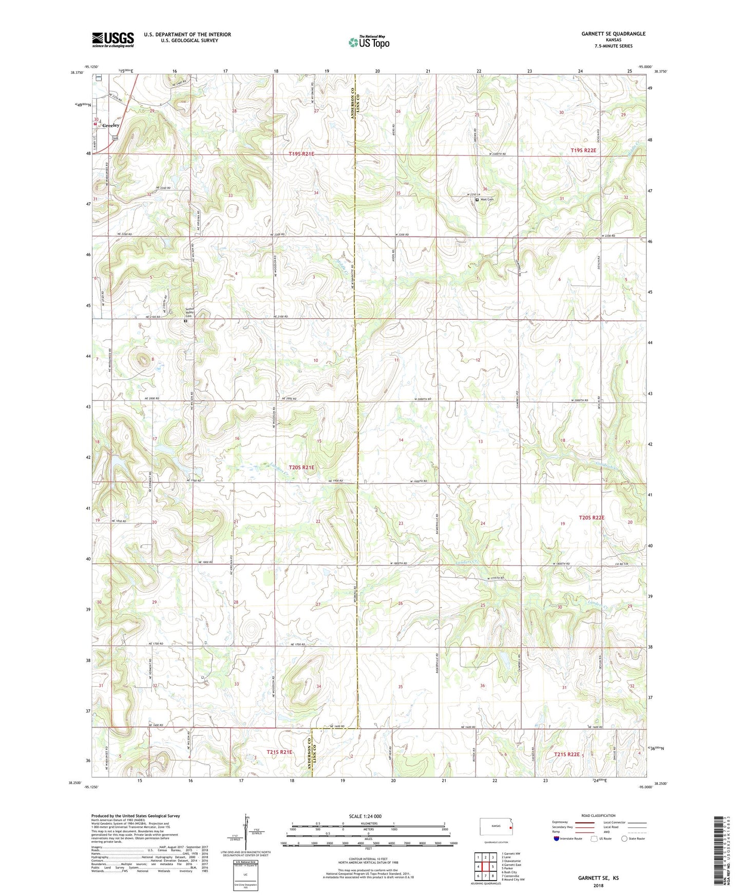
2022 topographic map quadrangle Garnett SE in the state of Kansas. Scale: 1:24000. Based on the newly updated USGS 7.5' US Topo map series, this map is in the following counties: Anderson, Linn. The map contains contour data, water features, and other items you are used to seeing on USGS maps, but also has updated roads and other features. This is the next generation of topographic maps. Printed on high-quality waterproof paper with UV fade-resistant inks.
Quads adjacent to this one:
West: Garnett East
Northwest: Garnett NW
North: Lane
Northeast: Osawatomie
East: Parker
Southeast: Mound City NW
South: Centerville
Southwest: Bush City
This map covers the same area as the classic USGS quad with code o38095c1.
Contains the following named places: Greeley Elementary School, Greeley Municipal Wastewater Treatment Facility, Saint John's Catholic Church, Sugarvale, Sutton Valley Cemetery, Township of Union, Township of Walker, Wait Cemetery, ZIP Code: 66033