MyTopo
Lorraine Kansas US Topo Map
Couldn't load pickup availability
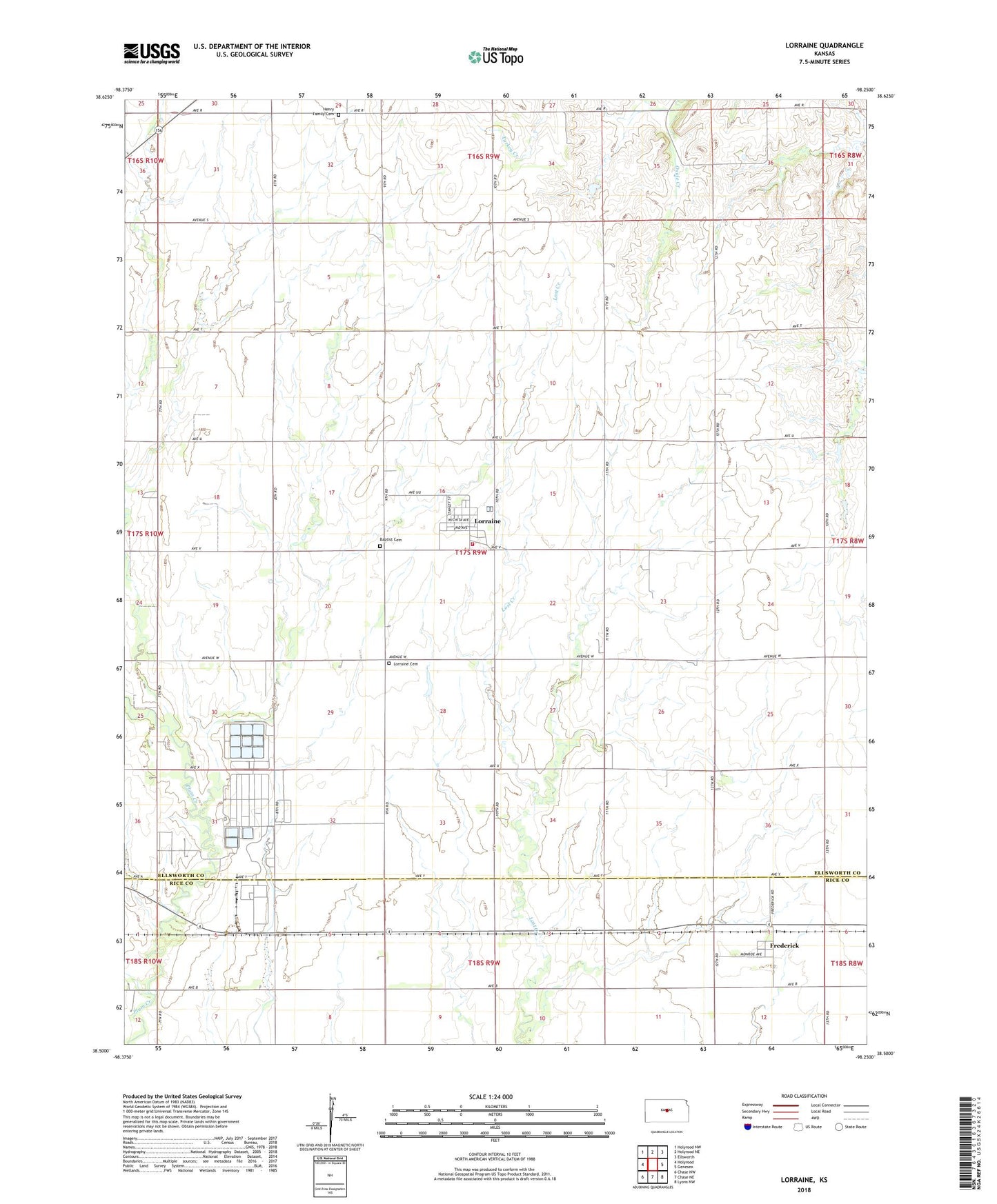
2022 topographic map quadrangle Lorraine in the state of Kansas. Scale: 1:24000. Based on the newly updated USGS 7.5' US Topo map series, this map is in the following counties: Ellsworth, Rice. The map contains contour data, water features, and other items you are used to seeing on USGS maps, but also has updated roads and other features. This is the next generation of topographic maps. Printed on high-quality waterproof paper with UV fade-resistant inks.
Quads adjacent to this one:
West: Holyrood
Northwest: Holyrood NW
North: Holyrood NE
Northeast: Ellsworth
East: Geneseo
Southeast: Lyons NW
South: Chase NE
Southwest: Chase NW
This map covers the same area as the classic USGS quad with code o38098e3.
Contains the following named places: Baptist Cemetery, Bredfeldt Oil Field, City of Frederick, City of Lorraine, Frederick, Green Garden Oil Field, Henry Family Cemetery, Lorraine, Lorraine Baptist Church, Lorraine Cemetery, Lorraine City Hall, Lorraine Fire Department, Lorraine North Oil Field, Lorraine Oil Field, Lorraine Wastewater Treatment Facility, Oxide, Prosper East Oil Field, Township of Green Garden, ZIP Code: 67459