MyTopo
Gorham Kansas US Topo Map
Couldn't load pickup availability
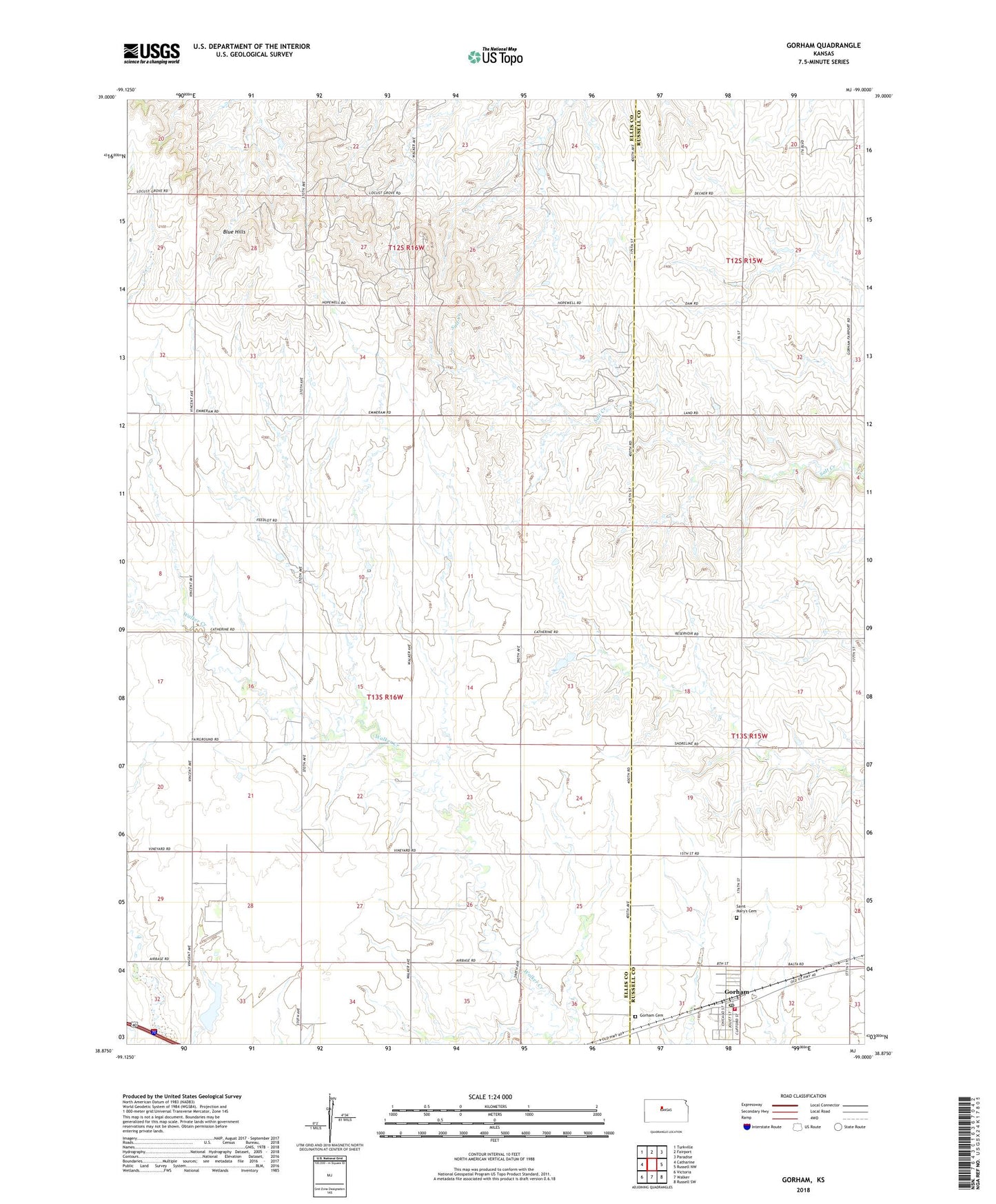
2022 topographic map quadrangle Gorham in the state of Kansas. Scale: 1:24000. Based on the newly updated USGS 7.5' US Topo map series, this map is in the following counties: Ellis, Russell. The map contains contour data, water features, and other items you are used to seeing on USGS maps, but also has updated roads and other features. This is the next generation of topographic maps. Printed on high-quality waterproof paper with UV fade-resistant inks.
Quads adjacent to this one:
West: Catharine
Northwest: Turkville
North: Fairport
Northeast: Paradise
East: Russell NW
Southeast: Russell SW
South: Walker
Southwest: Victoria
This map covers the same area as the classic USGS quad with code o38099h1.
Contains the following named places: Airbase East Oil Field, Airbase Oil Field, Blue Hill Southeast Oil Field, Blue Hills, City of Gorham, Emmeram Northeast Oil Field, Emmeram Oil Field, Fairport Oil Field, Gorham, Gorham City Hall, Gorham Community Church, Gorham Fire District 1, Gorham High School, Gorham Post Office, Kune Oil Field, Prairie Lawn Cemetery, Reich Oil Field, Saint Marys Cemetery, Saint Mary's Help of Christians Catholic Church, Township of Herzog, United Agricultural Service Grain Elevator Number 1, Victoria Pratt Airport, ZIP Code: 67640