MyTopo
Walker Kansas US Topo Map
Couldn't load pickup availability
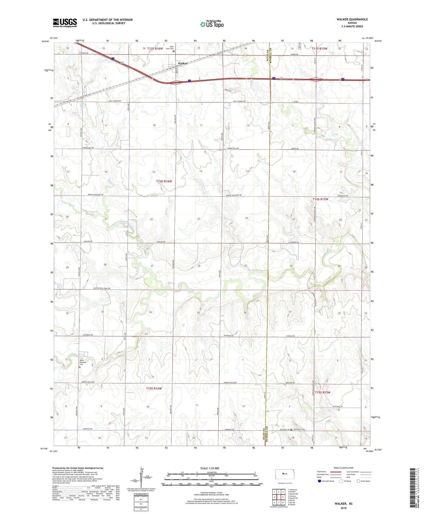
2022 topographic map quadrangle Walker in the state of Kansas. Scale: 1:24000. Based on the newly updated USGS 7.5' US Topo map series, this map is in the following counties: Ellis, Russell. The map contains contour data, water features, and other items you are used to seeing on USGS maps, but also has updated roads and other features. This is the next generation of topographic maps. Printed on high-quality waterproof paper with UV fade-resistant inks.
Quads adjacent to this one:
West: Victoria
Northwest: Catharine
North: Gorham
Northeast: Russell NW
East: Russell SW
Southeast: Galatia
South: Otis NE
Southwest: Pfeifer
This map covers the same area as the classic USGS quad with code o38099g1.
Contains the following named places: Dinkel Airport, Mud Creek, North Fork Big Creek, Saint Anns Cemetery, Saint Boniface Cemetery, Township of Victoria, United Agricultural Service Grain Elevator Number 8, Victoria Wastewater Plant, Vincent School, Walker, Winterset, Winterset Cemetery, ZIP Code: 67674