MyTopo
Greenleaf Kansas US Topo Map
Couldn't load pickup availability
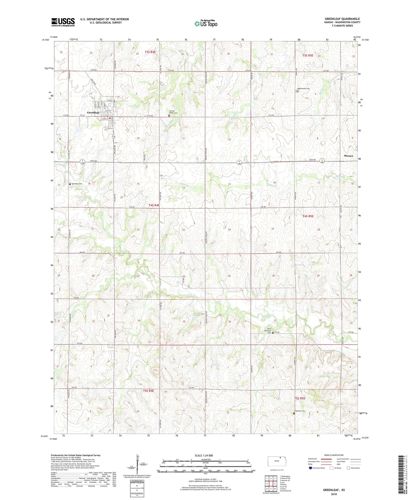
2022 topographic map quadrangle Greenleaf in the state of Kansas. Scale: 1:24000. Based on the newly updated USGS 7.5' US Topo map series, this map is in the following counties: Washington. The map contains contour data, water features, and other items you are used to seeing on USGS maps, but also has updated roads and other features. This is the next generation of topographic maps. Printed on high-quality waterproof paper with UV fade-resistant inks.
Quads adjacent to this one:
West: Linn
Northwest: Washington
North: Hanover SW
Northeast: Hanover SE
East: Barnes
Southeast: Greenleaf SE
South: Kimeo
Southwest: Linn SE
This map covers the same area as the classic USGS quad with code o39096f8.
Contains the following named places: Chepstow Cemetery, City of Greenleaf, Greenleaf, Greenleaf Ambulance Service, Greenleaf Fire District 3, Greenleaf Wastewater Treatment Plant, Koloko, Maplewood Cemetery, Round Grove Cemetery, Sacred Heart Catholic Church, Sacred Heart Cemetery, Saint Boniface Cemetery, Township of Greenleaf, Trinity Lutheran Church, ZIP Code: 66943