MyTopo
Gridley Kansas US Topo Map
Couldn't load pickup availability
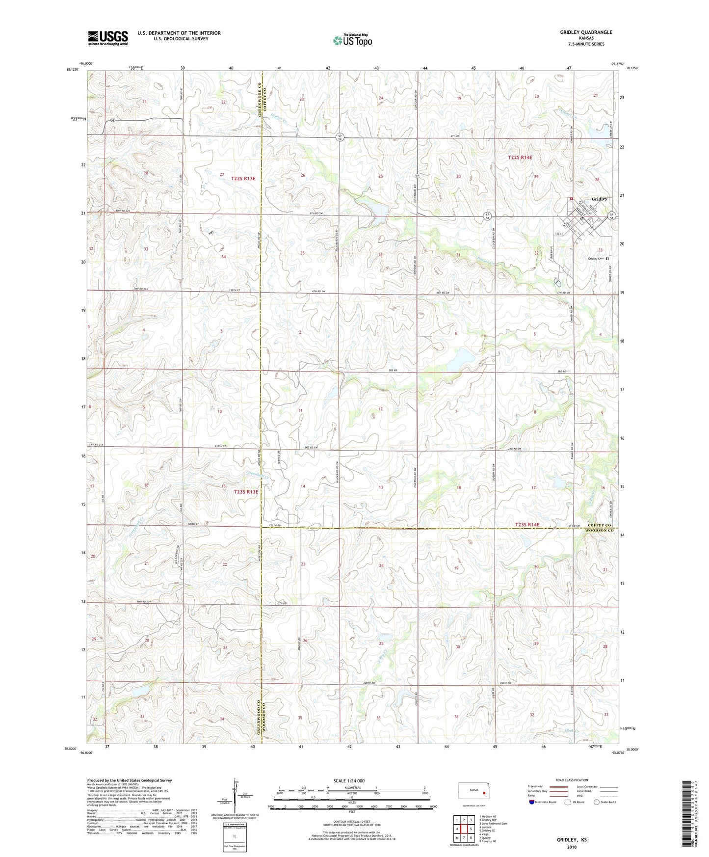
2022 topographic map quadrangle Gridley in the state of Kansas. Scale: 1:24000. Based on the newly updated USGS 7.5' US Topo map series, this map is in the following counties: Coffey, Greenwood, Woodson. The map contains contour data, water features, and other items you are used to seeing on USGS maps, but also has updated roads and other features. This is the next generation of topographic maps. Printed on high-quality waterproof paper with UV fade-resistant inks.
Quads adjacent to this one:
West: Lamont
Northwest: Madison NE
North: Gridley NW
Northeast: John Redmond Dam
East: Gridley SE
Southeast: Toronto NE
South: Quincy
Southwest: Virgil
This map covers the same area as the classic USGS quad with code o38095a8.
Contains the following named places: Church of the Brethren, City of Gridley, Coffey County Fire District 1 Station 4, Coffey County Library Gridley Branch, Dunaway Oil Field, Gridley, Gridley Cemetery, Gridley Christian Church, Gridley City Hall, Gridley Dam, Gridley Elementary School, Gridley Lake, Gridley Post Office, Gridley Sewer Treatment Plant, Gridly United Methodist Church, Le Roy Co - Operative Association Grain Elevator Number 2, Southern Coffey County Junior High School, Township of Liberty, Virgil North Oil Field, Windy Point School, ZIP Code: 66852