MyTopo
Virgil Kansas US Topo Map
Couldn't load pickup availability
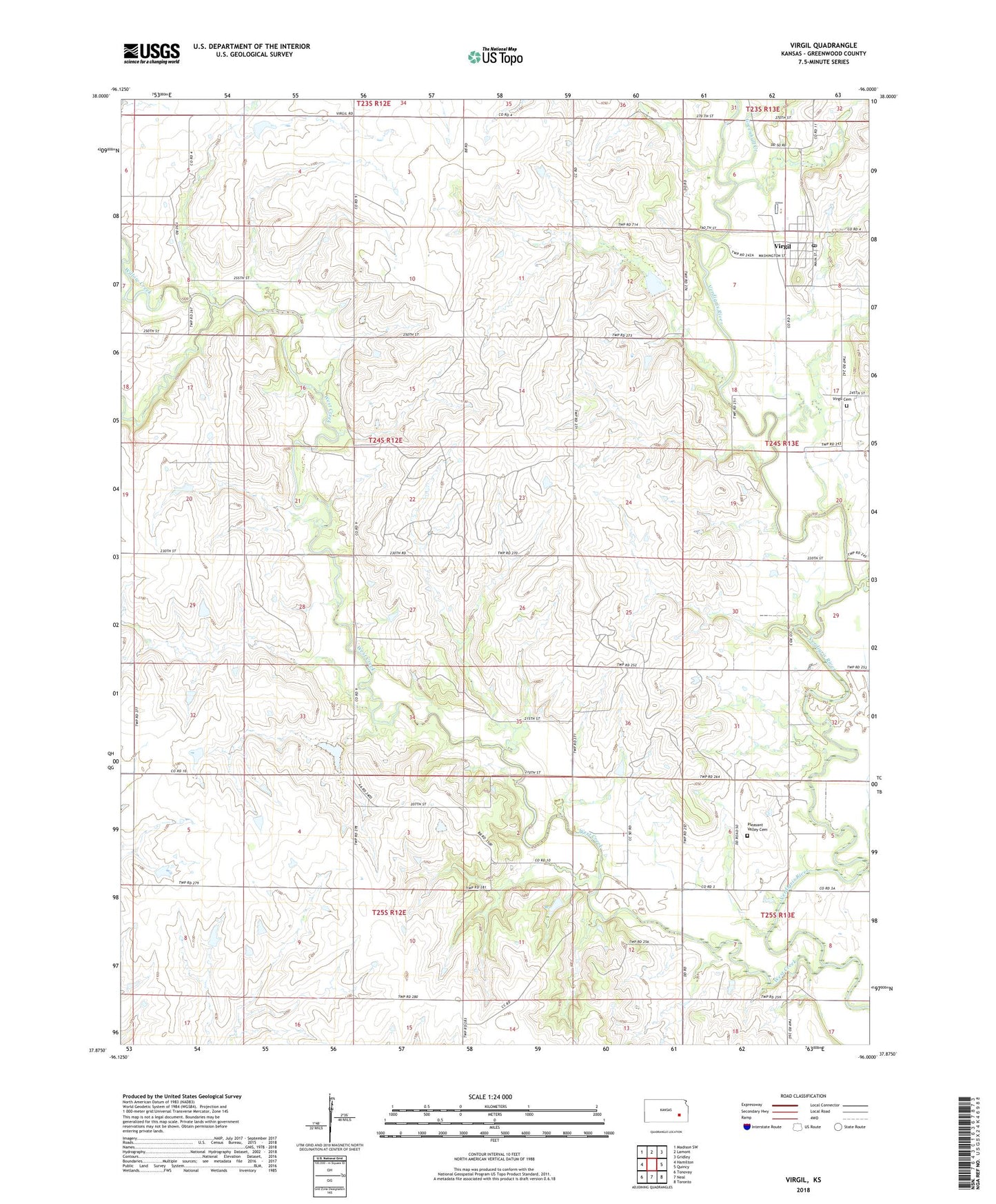
2022 topographic map quadrangle Virgil in the state of Kansas. Scale: 1:24000. Based on the newly updated USGS 7.5' US Topo map series, this map is in the following counties: Greenwood. The map contains contour data, water features, and other items you are used to seeing on USGS maps, but also has updated roads and other features. This is the next generation of topographic maps. Printed on high-quality waterproof paper with UV fade-resistant inks.
Quads adjacent to this one:
West: Hamilton
Northwest: Madison SW
North: Lamont
Northeast: Gridley
East: Quincy
Southeast: Toronto
South: Neal
Southwest: Tonovay
This map covers the same area as the classic USGS quad with code o37096h1.
Contains the following named places: City of Virgil, Greenhall Creek, Hinchman Oil Field, Homer Creek, Pleasant Valley Cemetery, Quincy Oil Field, Slate Creek, Sleeley-Wick Oil Field, Township of Lane, Virgil, Virgil Cemetery, Virgil City Hall, Virgil Oil Field, Virgil Post Office, Virgil Volunteer Fire Department, Virgil Wastewater Treatment Facility, West Creek, Willow Creek, Woodson County Co - Operative Association Grain Elevator Number 2, ZIP Code: 66870