MyTopo
Hackney Kansas US Topo Map
Couldn't load pickup availability
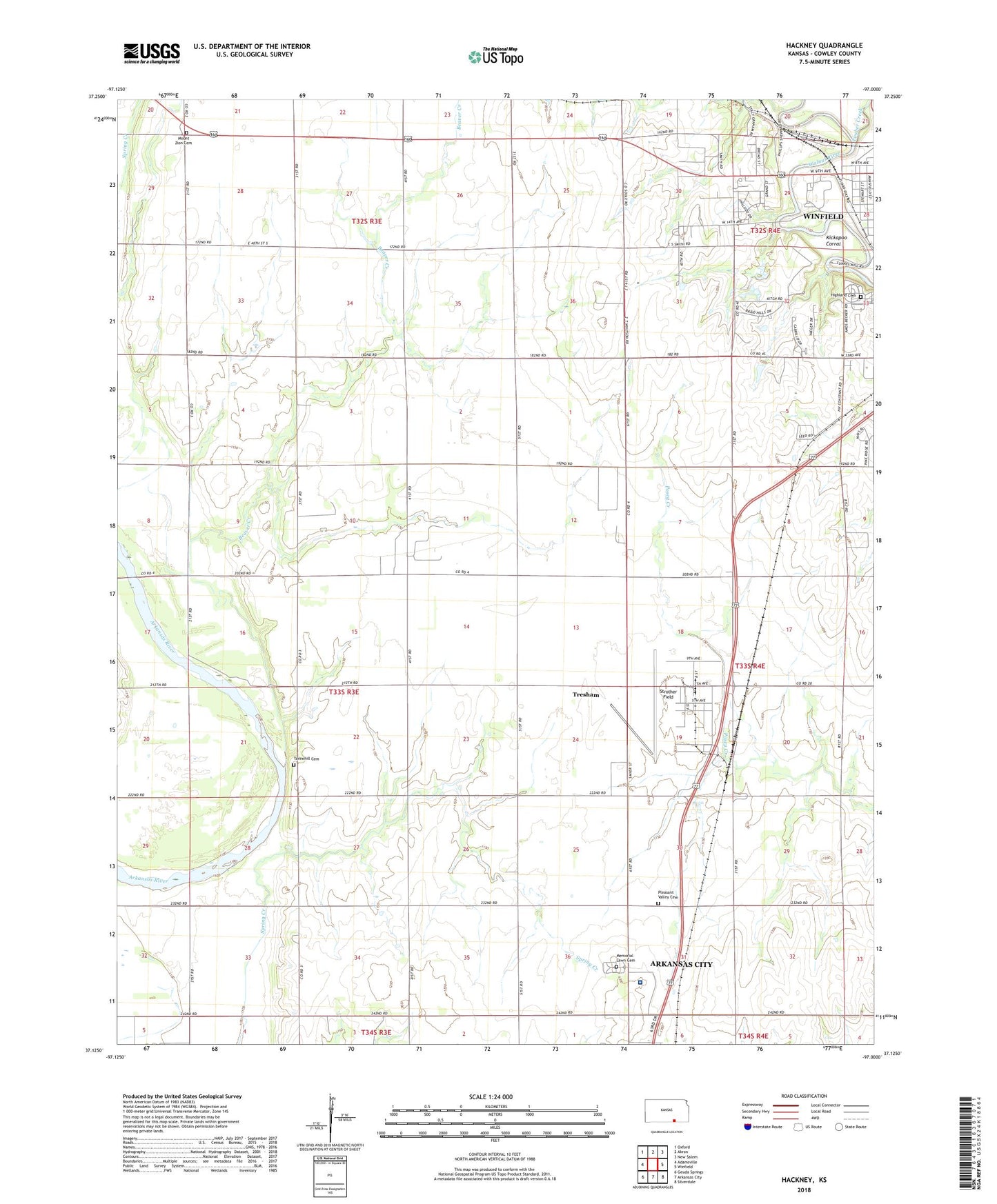
2022 topographic map quadrangle Hackney in the state of Kansas. Scale: 1:24000. Based on the newly updated USGS 7.5' US Topo map series, this map is in the following counties: Cowley. The map contains contour data, water features, and other items you are used to seeing on USGS maps, but also has updated roads and other features. This is the next generation of topographic maps. Printed on high-quality waterproof paper with UV fade-resistant inks.
Quads adjacent to this one:
West: Adamsville
Northwest: Oxford
North: Akron
Northeast: New Salem
East: Winfield
Southeast: Silverdale
South: Arkansas City
Southwest: Geuda Springs
This map covers the same area as the classic USGS quad with code o37097b1.
Contains the following named places: Beaver Creek, Bryant School, Centennial School, Cowley County Historical Museum, Dunamis Church, Easterly School, Enterprise School, Fair View School, Graham Oil Field, Hackney Baptist Church, Highland Cemetery, Hill View School, Holland School, Kickapoo Corral, KKLE - AM (Winfield), KNIC-AM (Winfield), Lone Star School, Martha Washington School, Memorial Lawn Cemetery, Mount Zion Cemetery, Mount Zion Church, Pleasant Valley Cemetery, Pleasant Valley Church, South Central Kansas Medical Center, Stayton South Oil Field, Strother Army Air Field, Strother Field, Strother Field Airport Industrial Park, Tannehill, Tannehill Cemetery, Tannehill School, Timber Creek, Township of Beaver, Tresham, Tunnel Mill Dam, Tyler Airport, Victor School, Winfield Country Club, Winfield Fairgrounds, Winfield Fairgrounds Speedway, Winfield Junction, Winfield Municipal Power Plant Number 2