MyTopo
Geuda Springs Kansas US Topo Map
Couldn't load pickup availability
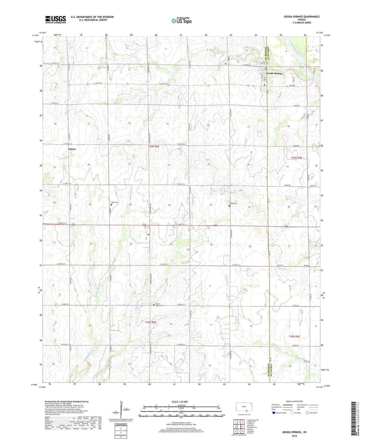
2022 topographic map quadrangle Geuda Springs in the state of Kansas. Scale: 1:24000. Based on the newly updated USGS 7.5' US Topo map series, this map is in the following counties: Sumner, Cowley. The map contains contour data, water features, and other items you are used to seeing on USGS maps, but also has updated roads and other features. This is the next generation of topographic maps. Printed on high-quality waterproof paper with UV fade-resistant inks.
Quads adjacent to this one:
West: Portland
Northwest: South Haven NE
North: Adamsville
Northeast: Hackney
East: Arkansas City
Southeast: Newkirk
South: Peckham
Southwest: Braman
This map covers the same area as the classic USGS quad with code o37097a2.
Contains the following named places: Ashton, Bitter Creek, Centerview School, City of Geuda Springs, Garden of Lollik Cemetery, Geuda Springs, Geuda Springs Post Office, Geuda Springs Wastewater Treatment Plant, Mount Hope Ark City United Methodist Church, Mount Hope Cemetery, Murphy Oil Field, Ohio School, Padgett Oil Field, Rauckman Oil Field, Salt Creek, Strother Air Field Number Two, Sumner County Fire District 10 Geuda Springs, Sumner County Fire District 11 Geuda Springs, Thacher School, Township of Walton, Work Cemetery, ZIP Code: 67051