MyTopo
Haddam Kansas US Topo Map
Couldn't load pickup availability
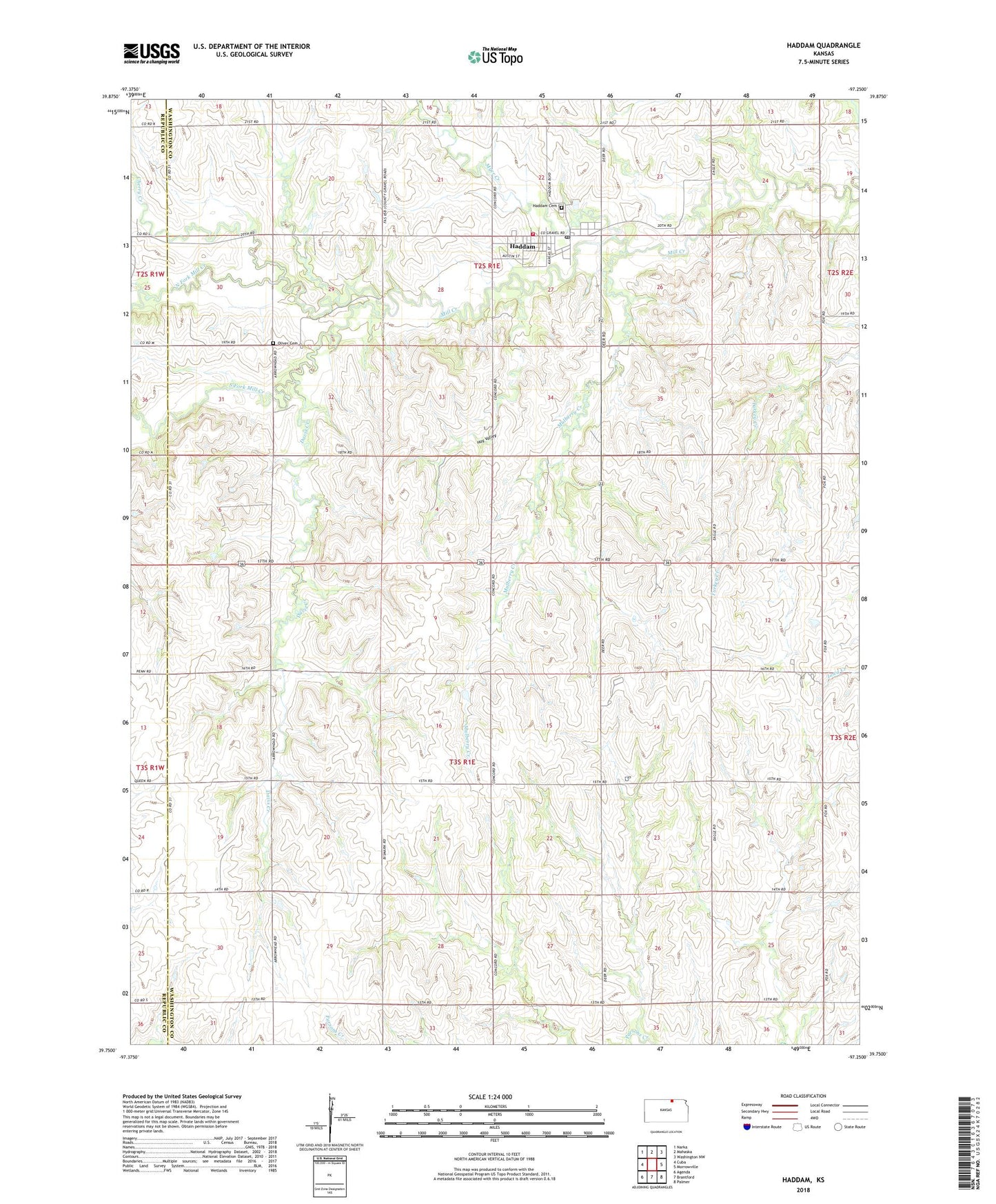
2022 topographic map quadrangle Haddam in the state of Kansas. Scale: 1:24000. Based on the newly updated USGS 7.5' US Topo map series, this map is in the following counties: Washington, Republic. The map contains contour data, water features, and other items you are used to seeing on USGS maps, but also has updated roads and other features. This is the next generation of topographic maps. Printed on high-quality waterproof paper with UV fade-resistant inks.
Quads adjacent to this one:
West: Cuba
Northwest: Narka
North: Mahaska
Northeast: Washington NW
East: Morrowville
Southeast: Palmer
South: Brantford
Southwest: Agenda
This map covers the same area as the classic USGS quad with code o39097g3.
Contains the following named places: Adee Landing Strip, Cherry Creek, Church of God of Prophecy, City of Haddam, Davis Creek, Haddam, Haddam Cemetery, Haddam City Hall, Haddam Community Golf Course, Haddam Fire District 6, Haddam Library, Haddam Post Office, Haddam United Methodist Church, Haddam Wastewater Plant, Hay Valley, Mulberry Creek, Myer Creek, North Central Elementary School, North Fork Mill Creek, Oliver Cemetery, South Fork Mill Creek, Township of Grant, Township of Haddam, ZIP Code: 66944