MyTopo
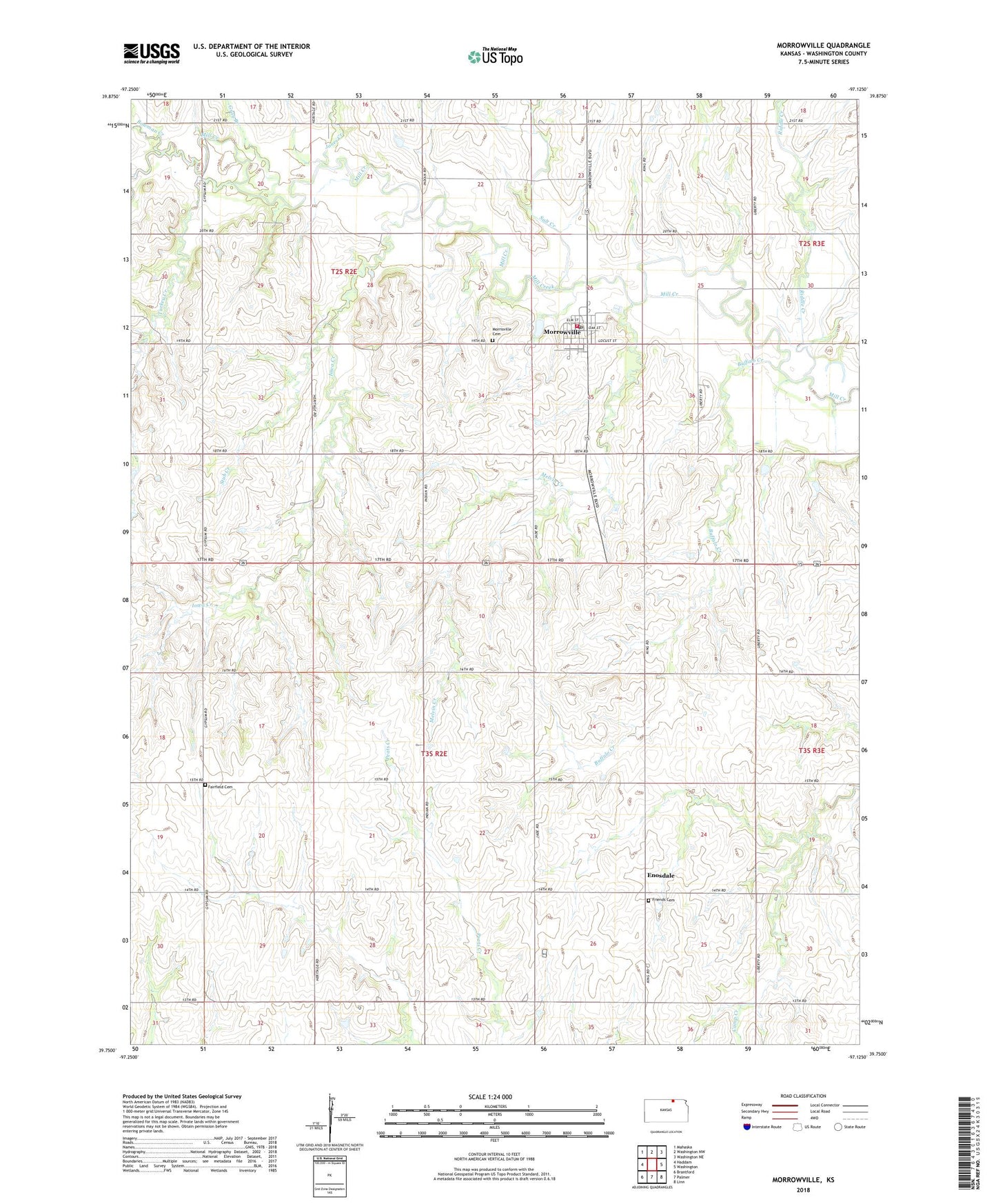
Morrowville Kansas US Topo Map
Couldn't load pickup availability
2022 topographic map quadrangle Morrowville in the state of Kansas. Scale: 1:24000. Based on the newly updated USGS 7.5' US Topo map series, this map is in the following counties: Washington. The map contains contour data, water features, and other items you are used to seeing on USGS maps, but also has updated roads and other features. This is the next generation of topographic maps. Printed on high-quality waterproof paper with UV fade-resistant inks.
Quads adjacent to this one:
West: Haddam
Northwest: Mahaska
North: Washington NW
Northeast: Washington NE
East: Washington
Southeast: Linn
South: Palmer
Southwest: Brantford
This map covers the same area as the classic USGS quad with code o39097g2.
Contains the following named places: Bowman Creek, Buffalo Creek, City of Morrowville, Dale Friends Cemetery, Dewitt, Enosdale, Fairfield Cemetery, Gray Branch, Iowa Creek, Jones Creek, Melvin Creek, Morrowville, Morrowville Cemetery, Morrowville Fire District 8, Morrowville Post Office, Morrowville Wastewater Plant, North Central High School, Riddle Creek, Salt Creek, Stub Creek, Township of Coleman, Township of Mill Creek, Turkey Creek