MyTopo
Hale Kansas US Topo Map
Couldn't load pickup availability
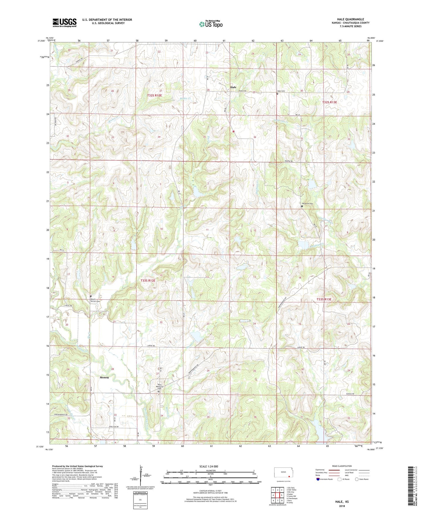
2022 topographic map quadrangle Hale in the state of Kansas. Scale: 1:24000. Based on the newly updated USGS 7.5' US Topo map series, this map is in the following counties: Chautauqua. The map contains contour data, water features, and other items you are used to seeing on USGS maps, but also has updated roads and other features. This is the next generation of topographic maps. Printed on high-quality waterproof paper with UV fade-resistant inks.
Quads adjacent to this one:
West: Sedan
Northwest: Elk Falls
North: Oak Valley
Northeast: Elk City
East: Caney NW
Southeast: Caney
South: Peru
Southwest: Chautauqua
This map covers the same area as the classic USGS quad with code o37096b1.
Contains the following named places: Brownville, Chautauqua County Rural Fire District 6, Deadman Creek, Fly Creek, Hale, Hale Cemetery, Hardrock Cemetery, Monett, Mount Vernon Cemetery, Riley Memorial Cemetery, Rupp Airport, Township of Salt Creek, Township of Washington