MyTopo
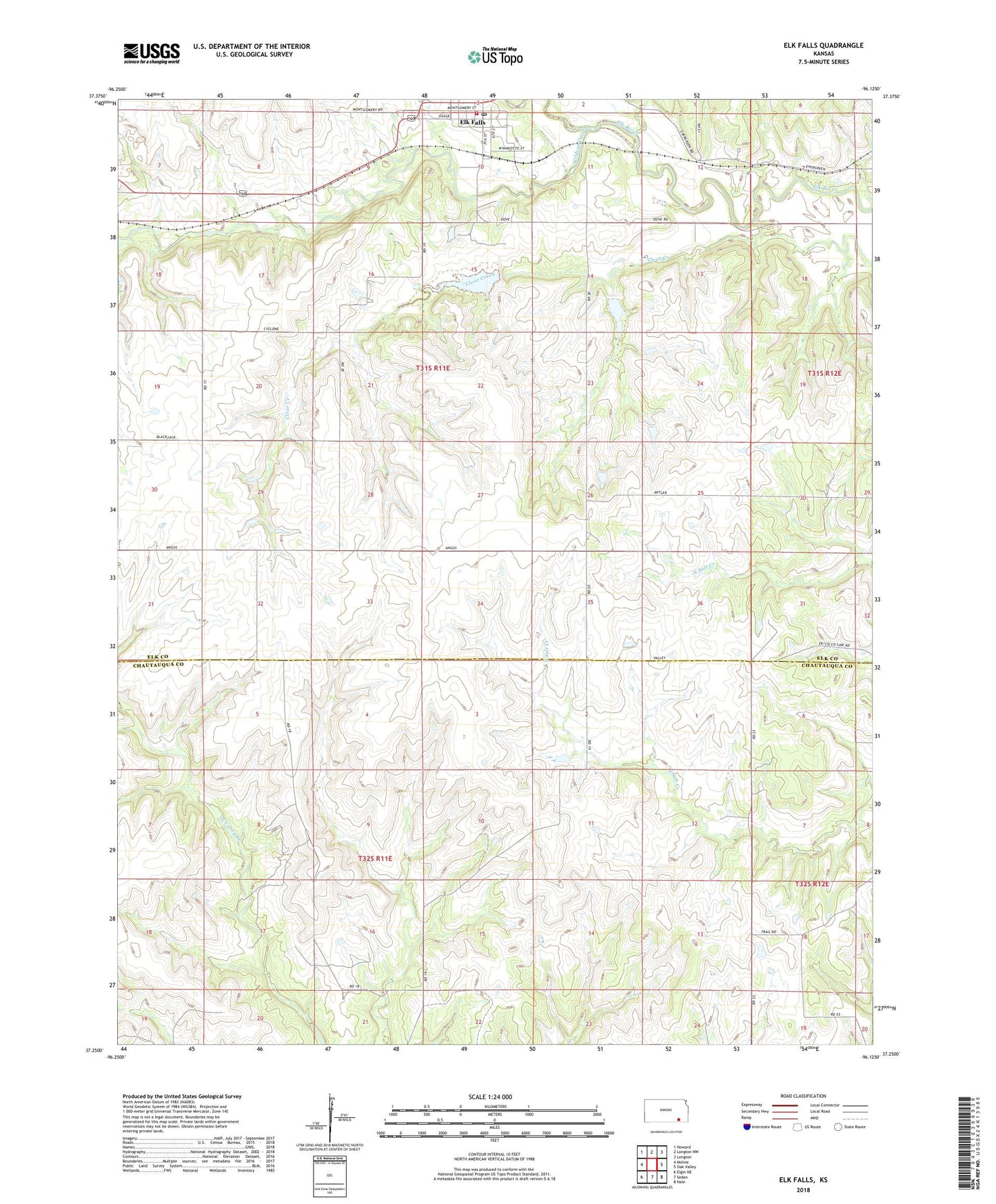
Elk Falls Kansas US Topo Map
Couldn't load pickup availability
2022 topographic map quadrangle Elk Falls in the state of Kansas. Scale: 1:24000. Based on the newly updated USGS 7.5' US Topo map series, this map is in the following counties: Elk, Chautauqua. The map contains contour data, water features, and other items you are used to seeing on USGS maps, but also has updated roads and other features. This is the next generation of topographic maps. Printed on high-quality waterproof paper with UV fade-resistant inks.
Quads adjacent to this one:
West: Moline
Northwest: Howard
North: Longton NW
Northeast: Longton
East: Oak Valley
Southeast: Hale
South: Sedan
Southwest: Elgin NE
This map covers the same area as the classic USGS quad with code o37096c2.
Contains the following named places: City of Elk Falls, Clear Creek, Elk County Rural Fire District Elk Falls Fire Department, Elk Falls, Elk Falls Calvery Chapel, Elk Falls City Hall, Elk Falls Fire Department, Elk Falls Post Office, Elk Falls United Methodist Church, Farmersburg, Kingdom Hall of Jehovah's Witnesses, Township of Elk Falls, Wildcat Creek