MyTopo
Sedan Kansas US Topo Map
Couldn't load pickup availability
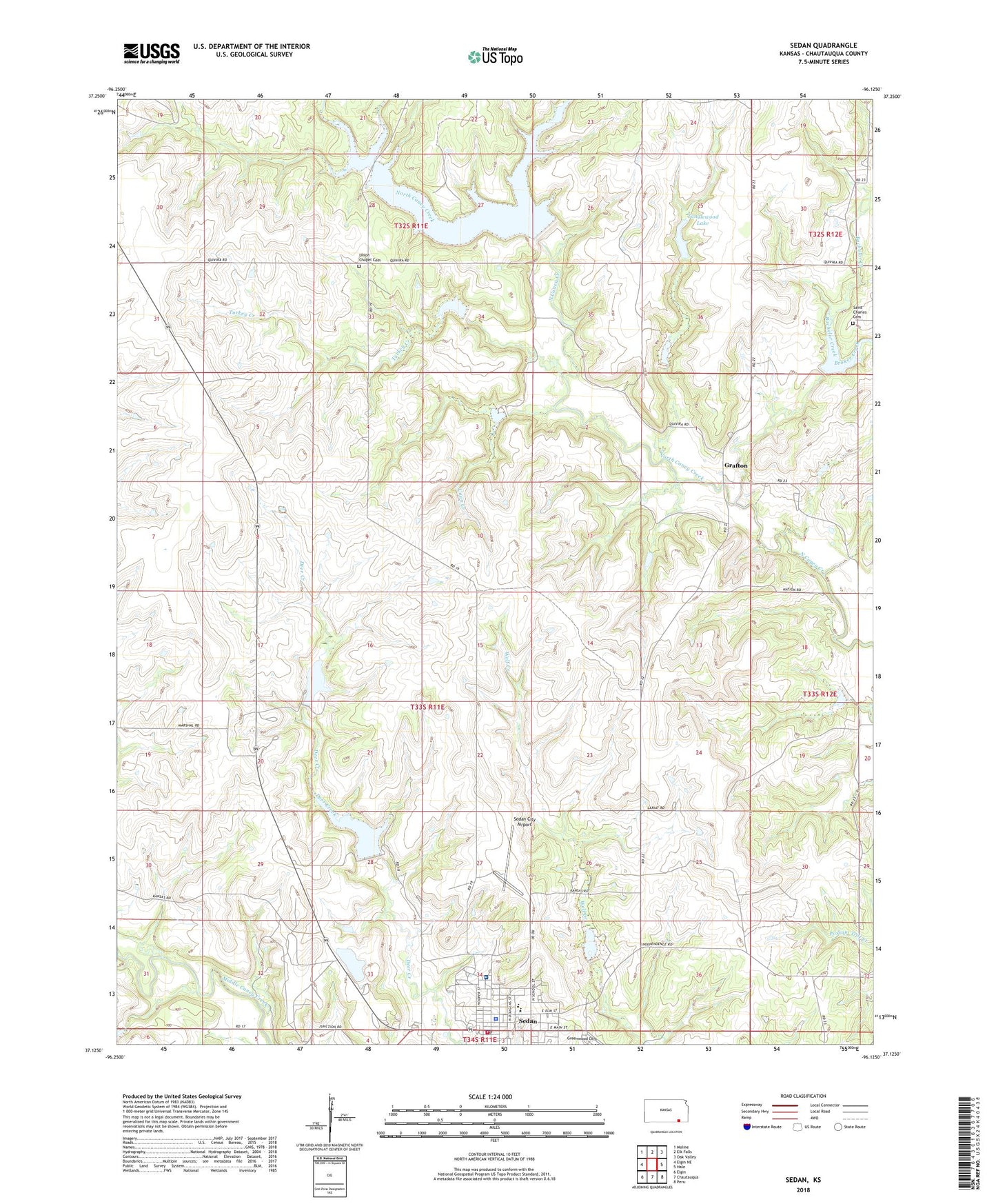
2022 topographic map quadrangle Sedan in the state of Kansas. Scale: 1:24000. Based on the newly updated USGS 7.5' US Topo map series, this map is in the following counties: Chautauqua. The map contains contour data, water features, and other items you are used to seeing on USGS maps, but also has updated roads and other features. This is the next generation of topographic maps. Printed on high-quality waterproof paper with UV fade-resistant inks.
Quads adjacent to this one:
West: Elgin NE
Northwest: Moline
North: Elk Falls
Northeast: Oak Valley
East: Hale
Southeast: Peru
South: Chautauqua
Southwest: Elgin
This map covers the same area as the classic USGS quad with code o37096b2.
Contains the following named places: Bachelor Creek, Broker Creek, Centre, Chautauqua County, Chautauqua County Courthouse, Chautauqua County Fairgrounds, Chautauqua County Health Department, Chautauqua County Jail, Chautauqua County Sheriff's Office, Church of Christ, City of Sedan, Coon Creek, Emmett Kelley Museum, Epiphany Episcopal Church, First Baptist Church, First Christian Church, Grafton, Quivira Camp, Saint Charles Cemetery, Sedan, Sedan Area Emergency Medical Services, Sedan Assembly of God Church, Sedan City Airport, Sedan City Dam, Sedan City Hall, Sedan City Hospital, Sedan City Lake, Sedan Country Club, Sedan Elementary School, Sedan High School, Sedan Police Department, Sedan Post Office, Sedan Public Library, Sedan Senior Center, Sedan Seventh Day Adventist Church, Sedan United Methodist Church, Sedan Volunteer Fire Department, Tanglewood Lake, Township of Lafayette, Township of Sedan, Turkey Creek, Union Chapel, Union Chapel Cemetery, ZIP Code: 67361