MyTopo
Osage City Kansas US Topo Map
Couldn't load pickup availability
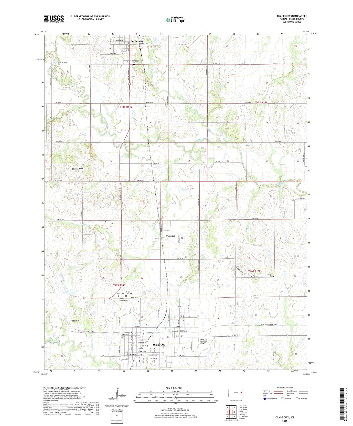
2022 topographic map quadrangle Osage City in the state of Kansas. Scale: 1:24000. Based on the newly updated USGS 7.5' US Topo map series, this map is in the following counties: Osage. The map contains contour data, water features, and other items you are used to seeing on USGS maps, but also has updated roads and other features. This is the next generation of topographic maps. Printed on high-quality waterproof paper with UV fade-resistant inks.
Quads adjacent to this one:
West: Miller
Northwest: Harveyville
North: Burlingame
Northeast: Carbondale
East: Lyndon NW
Southeast: Lyndon
South: Osage City SE
Southwest: Reading
This map covers the same area as the classic USGS quad with code o38095f7.
Contains the following named places: American Medical Response, Burlingame City Cemetery, Burlingame Wastewater Plant, City of Osage City, Community Covenant Church, Dragoon, Dry Creek, Elkhorn Knob, First Presbyterian Church, Flint Hills Baptist Church, Grace Assembly Church, Grace Lutheran Church, Kansas Department of Transportation Area 2 Shop, Kibbie Creek, Lincoln Park, Mount Calvary Cemetery, Mud Creek, Osage City, Osage City Cemetery, Osage City Church of Christ, Osage City Elementary School, Osage City Fairgrounds, Osage City Hall, Osage City High School, Osage City Middle School, Osage City Municipal Airport, Osage City Police Department, Osage City Post Office, Osage City Public Library, Osage City Unified School District Office, Osage City United Methodist Church, Osage County Fire District 2 Osage City, Osage County Senior Center, Paradise Mobile Home Park, Peterton, Plum Creek, Saint Patrick Catholic Church, Smith Creek, Soldier Creek, Solid Rock Action Center Church, Sunflower Mobile Home Park, Switzler Creek, Township of Dragoon, Township of Superior, Union Cemetery