MyTopo
Heizer Kansas US Topo Map
Couldn't load pickup availability
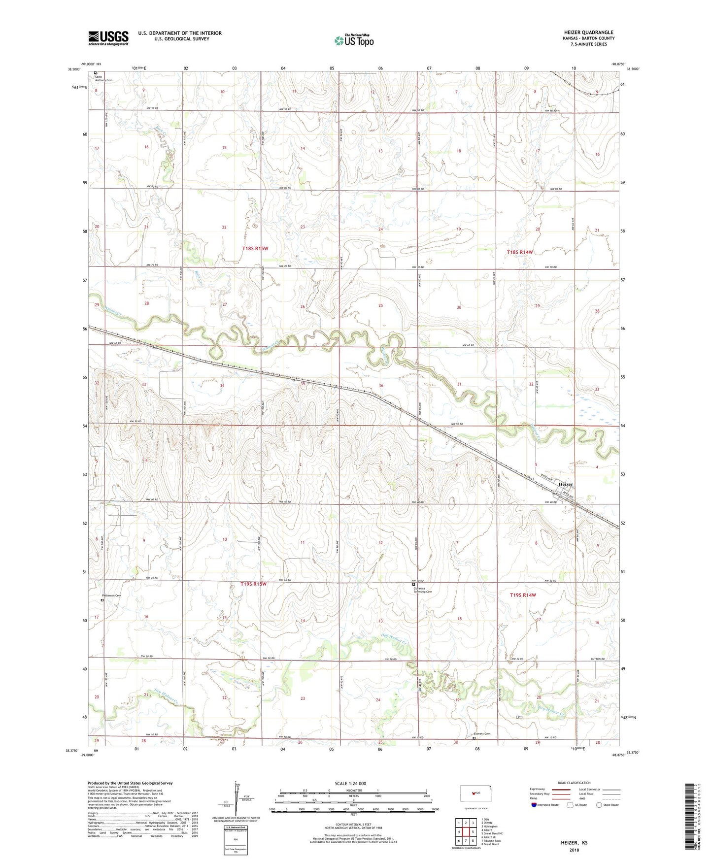
2022 topographic map quadrangle Heizer in the state of Kansas. Scale: 1:24000. Based on the newly updated USGS 7.5' US Topo map series, this map is in the following counties: Barton. The map contains contour data, water features, and other items you are used to seeing on USGS maps, but also has updated roads and other features. This is the next generation of topographic maps. Printed on high-quality waterproof paper with UV fade-resistant inks.
Quads adjacent to this one:
West: Albert
Northwest: Otis
North: Olmitz
Northeast: Hoisington
East: Great Bend NE
Southeast: Great Bend
South: Pawnee Rock
Southwest: Albert SE
This map covers the same area as the classic USGS quad with code o38098d8.
Contains the following named places: Boot Creek, Clarence, Clarence Township Cemetery, Everett Cemetery, Heizer, Patterson Cemetery, Pleasant View School, Saint Anthony Cemetery, Township of Clarence, Township of Walnut, Walnut Ridge School