MyTopo
Hoisington Kansas US Topo Map
Couldn't load pickup availability
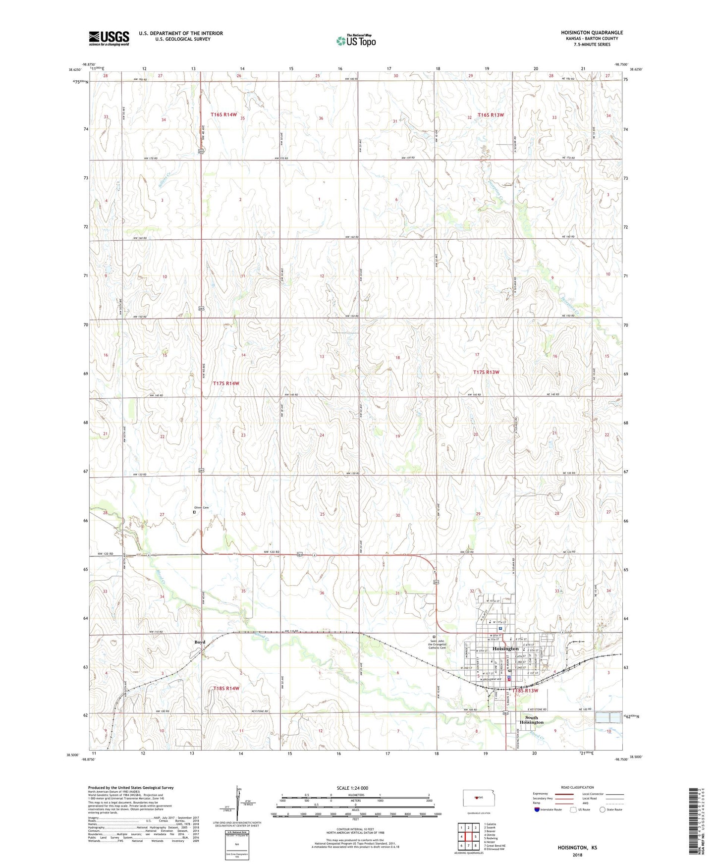
2022 topographic map quadrangle Hoisington in the state of Kansas. Scale: 1:24000. Based on the newly updated USGS 7.5' US Topo map series, this map is in the following counties: Barton. The map contains contour data, water features, and other items you are used to seeing on USGS maps, but also has updated roads and other features. This is the next generation of topographic maps. Printed on high-quality waterproof paper with UV fade-resistant inks.
Quads adjacent to this one:
West: Olmitz
Northwest: Galatia
North: Susank
Northeast: Beaver
East: Redwing
Southeast: Ellinwood NW
South: Great Bend NE
Southwest: Heizer
This map covers the same area as the classic USGS quad with code o38098e7.
Contains the following named places: Boyd, Boyd Oil Field, Buena Vista, Cardinal Park Shopping Center, City of Hoisington, Clara Barton Hospital, Concordia Lutheran Church, Emmanuel Lutheran Church, First Street Church of God, First United Methodist Church, Great Bend Co - Operative Association Grain Elevator Number 3, Hoisington, Hoisington Activity Center, Hoisington Bible Church, Hoisington Church of the Nazarene, Hoisington City Hall, Hoisington Emergency Medical Services, Hoisington High School, Hoisington Historical Society Museum, Hoisington Middle School, Hoisington Municipal Power Plant, Hoisington Police Department, Hoisington Post Office, Hoisington Public Library, Hoisington Sewer Treatment Plant, Hoisington Volunteer Fire Department, KHOK-FM (Hoisington), Lincoln Elementary School, Living Joy Community Church, Maherville, New Life Baptist Church, Olivet Cemetery, Roosevelt Elementary School, Saint John the Evangelist Catholic Cemetery, Saint John the Evangelist Catholic Church, Saint John the Evangelist Elementary School, South Hoisington, Township of Albion, Township of North Homestead, United Agricultural Service Grain Elevator Number 3, ZIP Code: 67544