MyTopo
Pawnee Rock Kansas US Topo Map
Couldn't load pickup availability
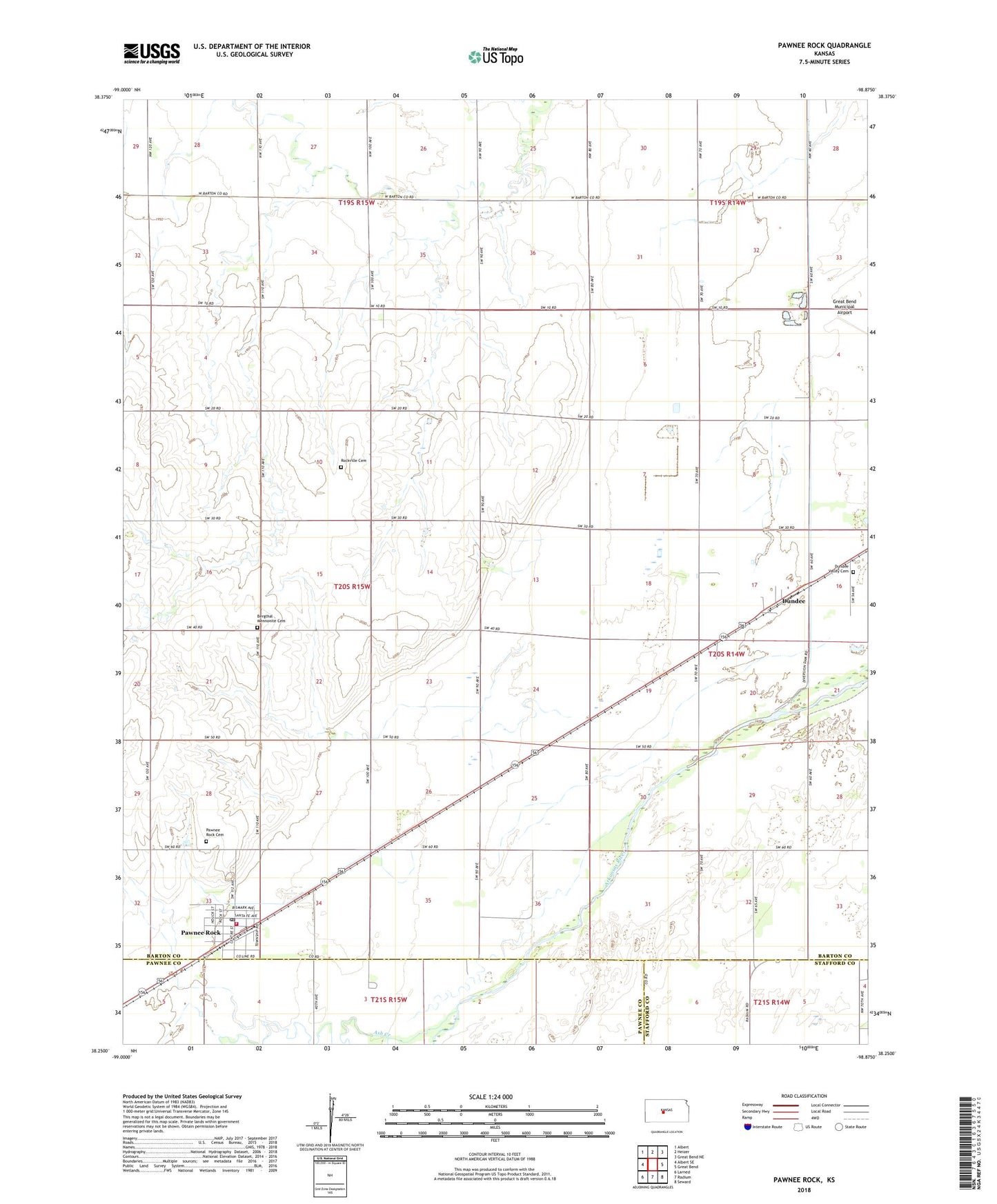
2022 topographic map quadrangle Pawnee Rock in the state of Kansas. Scale: 1:24000. Based on the newly updated USGS 7.5' US Topo map series, this map is in the following counties: Barton, Pawnee, Stafford. The map contains contour data, water features, and other items you are used to seeing on USGS maps, but also has updated roads and other features. This is the next generation of topographic maps. Printed on high-quality waterproof paper with UV fade-resistant inks.
Quads adjacent to this one:
West: Albert SE
Northwest: Albert
North: Heizer
Northeast: Great Bend NE
East: Great Bend
Southeast: Seward
South: Radium
Southwest: Larned
This map covers the same area as the classic USGS quad with code o38098c8.
Contains the following named places: Ash Creek, Bergthal Mennonite Cemetery, Bergthal Mennonite Church, City of Pawnee Rock, Dundee, Dundee Valley Cemetery, Great Bend Co - Operative Association Grain Elevator Number 2, Great Bend Co - Operative Association Grain Elevator Number 3, New Jerusalem Church, North Fork Little Arkansas River, Pawnee Rock, Pawnee Rock Cemetery, Pawnee Rock Christian Church, Pawnee Rock Elementary School, Pawnee Rock Junior High School, Pawnee Rock Post Office, Pawnee Rock Preschool, Pawnee Rock State Park, Pawnee Rock Volunteer Fire Department, Pawnee Rock Water Treatment Facility, Rockville Cemetery, Township of Pawnee Rock, ZIP Code: 67567