MyTopo
Laclede Kansas US Topo Map
Couldn't load pickup availability
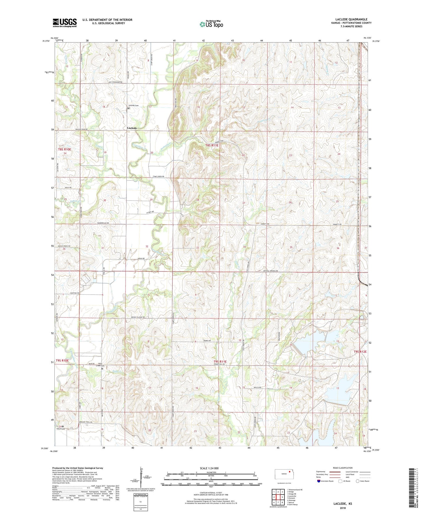
2022 topographic map quadrangle Laclede in the state of Kansas. Scale: 1:24000. Based on the newly updated USGS 7.5' US Topo map series, this map is in the following counties: Pottawatomie. The map contains contour data, water features, and other items you are used to seeing on USGS maps, but also has updated roads and other features. This is the next generation of topographic maps. Printed on high-quality waterproof paper with UV fade-resistant inks.
Quads adjacent to this one:
West: Louisville
Northwest: Westmoreland NE
North: Onaga
Northeast: Onaga NE
East: Emmett
Southeast: Saint Marys
South: Belvue
Southwest: Wamego
This map covers the same area as the classic USGS quad with code o39096c2.
Contains the following named places: Coal Creek, Indian Creek, Laclede, Laclede Cemetery, Polly Creek, Polly Creek Cemetery, Pomeroy Creek, Red Vermillion Crossing, Township of Belvue, Township of Center, Vieux Cemetery