MyTopo
Wamego Kansas US Topo Map
Couldn't load pickup availability
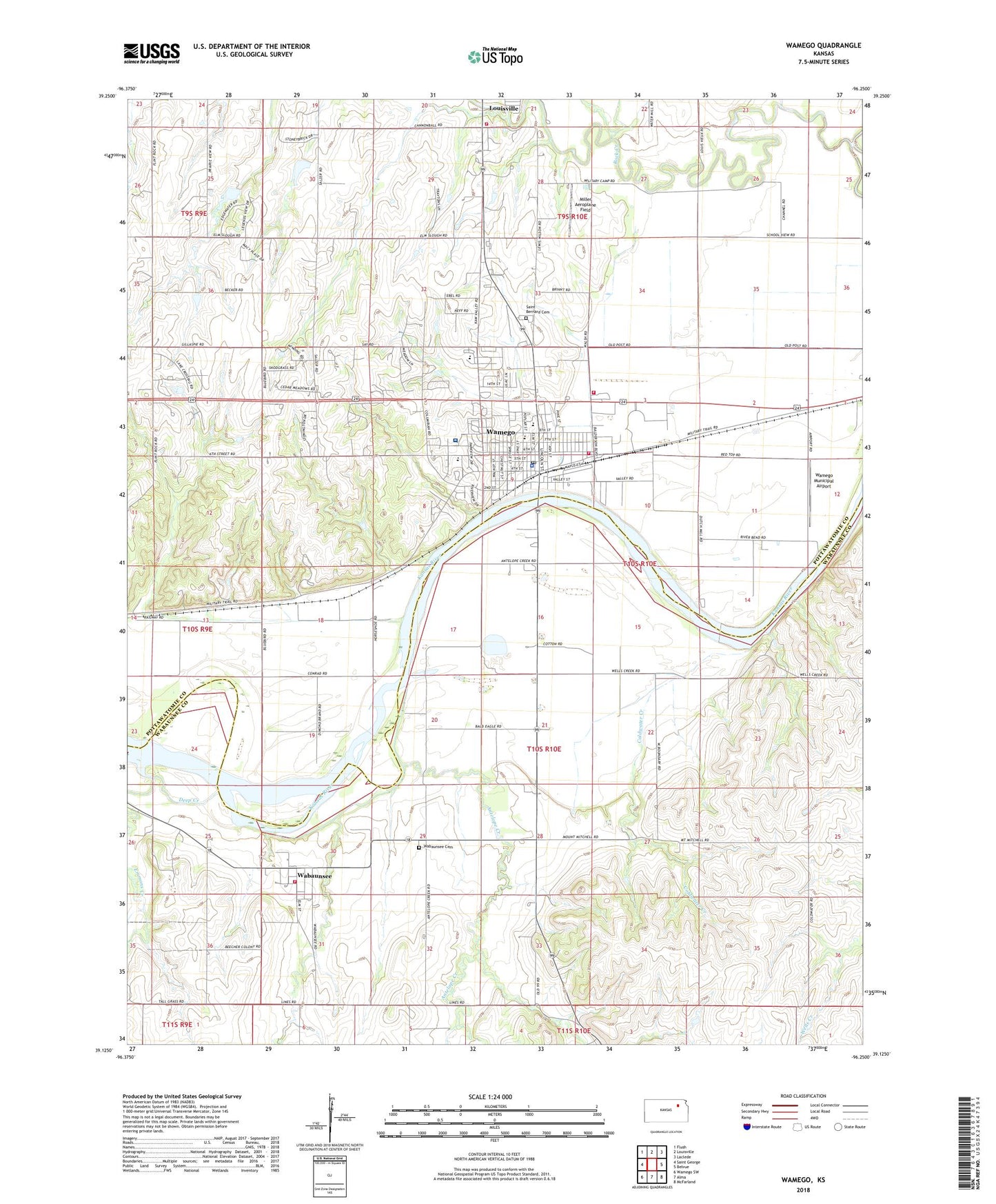
2022 topographic map quadrangle Wamego in the state of Kansas. Scale: 1:24000. Based on the newly updated USGS 7.5' US Topo map series, this map is in the following counties: Pottawatomie, Wabaunsee. The map contains contour data, water features, and other items you are used to seeing on USGS maps, but also has updated roads and other features. This is the next generation of topographic maps. Printed on high-quality waterproof paper with UV fade-resistant inks.
Quads adjacent to this one:
West: Saint George
Northwest: Flush
North: Louisville
Northeast: Laclede
East: Belvue
Southeast: McFarland
South: Alma
Southwest: Wamego SW
This map covers the same area as the classic USGS quad with code o39096b3.
Contains the following named places: Antelope Creek, Bretz's Mobile Home Park, Central Elementary School, City of Louisville, City of Wamego, Coldwater Creek, Columbian Theatre, Deep Creek, Farmers Union Co - Operative Business Association Grain Elevator Number 3, First Baptist Church, First United Methodist Church, Kansas Highway Patrol Troop B Pottawatomie, KHCA - FM (Manhattan), Louisville Township Fire Department, Miller Aeroplane Field, Mobile Villa Trailer Court, Mount Calvary Lutheran Church, New Life Baptist Church, Oz Museum, Pottawatomie County Emergency Medical Services, Pottawatomie County Fire District 7 Rural Wamego, Riverside Mobile Home Park, Saint Bernard Cemetery, Saint Bernard's Catholic Church, Saint Luke's Episcopal Church, Shiloh Christian Church, Township of Wamego, Trinity Baptist Church, Wabaunsee, Wabaunsee Cemetery, Wabaunsee Census Designated Place, Wabaunsee Township Fire District 8, Wamego, Wamego Chamber of Commerce, Wamego Church of God, Wamego City Hall, Wamego Country Club, Wamego Family Worship Center Assembly of God, Wamego Fire Department, Wamego First Presbyterian Church, Wamego Health Center, Wamego High School, Wamego Historical Society and Museum, Wamego Industrial Park, Wamego Law Enforcement Center, Wamego Middle School, Wamego Municipal Airport, Wamego Municipal Power Plant, Wamego Post Office, Wamego Public Library, Wamego Senior Center, Wamego Unified School District Office, Wamego Wastewater Treatment, West Elementary School, ZIP Code: 66547