MyTopo
Onaga Kansas US Topo Map
Couldn't load pickup availability
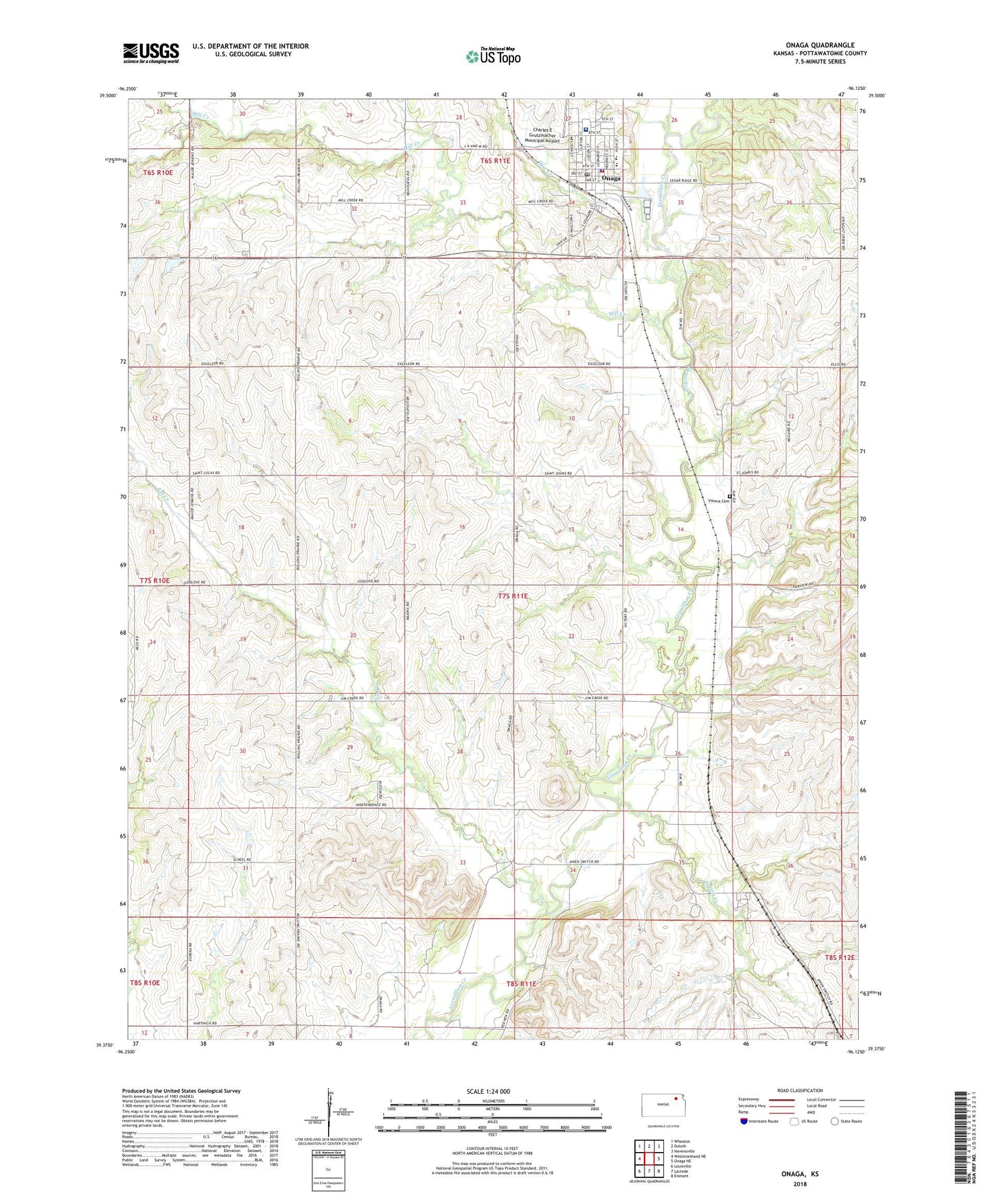
2022 topographic map quadrangle Onaga in the state of Kansas. Scale: 1:24000. Based on the newly updated USGS 7.5' US Topo map series, this map is in the following counties: Pottawatomie. The map contains contour data, water features, and other items you are used to seeing on USGS maps, but also has updated roads and other features. This is the next generation of topographic maps. Printed on high-quality waterproof paper with UV fade-resistant inks.
Quads adjacent to this one:
West: Westmoreland NE
Northwest: Wheaton
North: Duluth
Northeast: Havensville
East: Onaga NE
Southeast: Emmett
South: Laclede
Southwest: Louisville
This map covers the same area as the classic USGS quad with code o39096d2.
Contains the following named places: Charles E Grutzmacher Municipal Airport, City of Onaga, Community Healthcare System - Onaga, Farmers Co - Operative Association Grain Elevator Number 4, Fellowship Baptist Church, Hise Creek, Jim Creek, Mill Creek, New Hope Lutheran Church, Onaga, Onaga City and Rural Fire Department, Onaga Fairgrounds, Onaga First Congregational United Church of Christ, Onaga Grade School, Onaga High School, Onaga Police Department, Onaga Post Office, Onaga Unified School District Office, Onaga Wastewater Treatment Facility, Pottawatomie Wabaunsee Regional Library Onaga Branch, Saint Vincent de Paul Catholic Church, Spring Creek, Township of Vienna, Vermillion Valley School, Vienna Cemetery, ZIP Code: 66521