MyTopo
Macksville Kansas US Topo Map
Couldn't load pickup availability
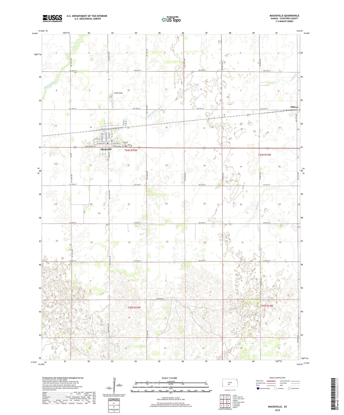
2022 topographic map quadrangle Macksville in the state of Kansas. Scale: 1:24000. Based on the newly updated USGS 7.5' US Topo map series, this map is in the following counties: Stafford. The map contains contour data, water features, and other items you are used to seeing on USGS maps, but also has updated roads and other features. This is the next generation of topographic maps. Printed on high-quality waterproof paper with UV fade-resistant inks.
Quads adjacent to this one:
West: Belpre
Northwest: Zook
North: Saint John SW
Northeast: Saint John North
East: Saint John South
Southeast: Byers
South: Hopewell
Southwest: Trousdale
This map covers the same area as the classic USGS quad with code o37098h8.
Contains the following named places: City of Macksville, Dillwyn, Farmington Cemetery, Free Methodist Church, Grace United Methodist Church, Kanza Co - Operative Association Grain Elevator Number 4, Kraeger Oil Field, Macksville, Macksville Christian Church, Macksville City Hall, Macksville City Library, Macksville Elementary School, Macksville Fire Department, Macksville High School, Macksville Oil and Gas Field, Macksville Police Department, Macksville Post Office, Macksville Wastewater Plant, Smith Field, Stafford County Flour Mills Grain Elevator Number 2, Township of Farmington, ZIP Code: 67557