MyTopo
Saint John North Kansas US Topo Map
Couldn't load pickup availability
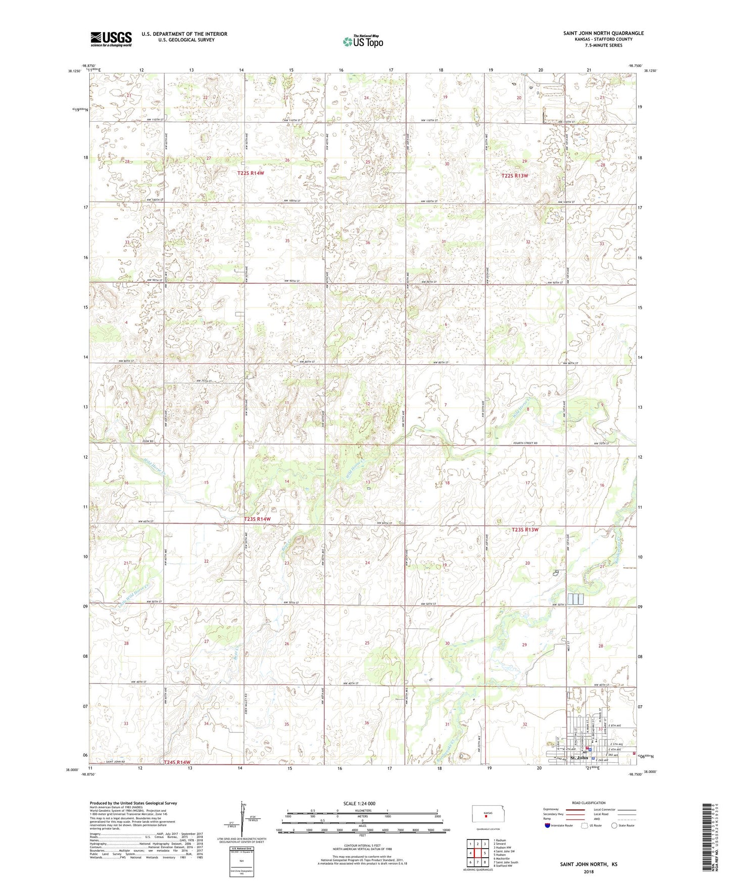
2022 topographic map quadrangle Saint John North in the state of Kansas. Scale: 1:24000. Based on the newly updated USGS 7.5' US Topo map series, this map is in the following counties: Stafford. The map contains contour data, water features, and other items you are used to seeing on USGS maps, but also has updated roads and other features. This is the next generation of topographic maps. Printed on high-quality waterproof paper with UV fade-resistant inks.
Quads adjacent to this one:
West: Saint John SW
Northwest: Radium
North: Seward
Northeast: Hudson NW
East: Hudson
Southeast: Stafford NW
South: Saint John South
Southwest: Macksville
This map covers the same area as the classic USGS quad with code o38098a7.
Contains the following named places: Bear Creek, City of St. John, Community Fellowship Church, Eden Valley Church of the Brethren, Eppley Lake, First Baptist Church, First Southern Baptist Church, Gilmore Lake, Ida Long Goodman Memorial Library, Kansas Highway Patrol Troop F Stafford, Kenilworth, Little Wild Horse Creek, Saint John the Apostle Catholic Church, Schulz Field, St. John, St. John Church of Christ, St. John City Hall, St. John Elementary School, St. John High School, St. John Police Department, St. John Post Office, St. John Science Museum, St. John Sewer Treatment Plant, St. John Volunteer Fire Department, Stafford County Courthouse, Stafford County Emergency Medical Services, Stafford County Jail, Stafford County Rural Fire Department Station 420, Stafford County Sheriff's Office, Township of Cleveland, ZIP Code: 67576