MyTopo
Maize Kansas US Topo Map
Couldn't load pickup availability
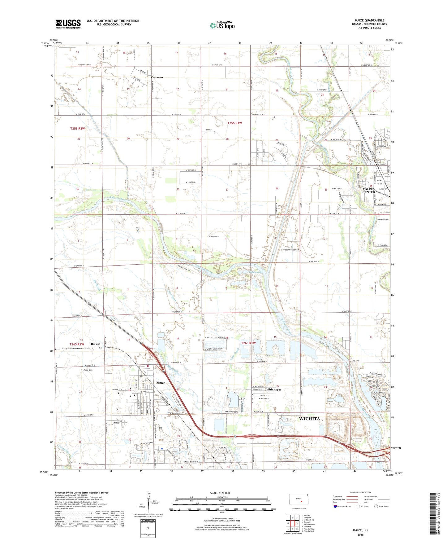
2022 topographic map quadrangle Maize in the state of Kansas. Scale: 1:24000. Based on the newly updated USGS 7.5' US Topo map series, this map is in the following counties: Sedgwick. The map contains contour data, water features, and other items you are used to seeing on USGS maps, but also has updated roads and other features. This is the next generation of topographic maps. Printed on high-quality waterproof paper with UV fade-resistant inks.
Quads adjacent to this one:
West: Colwich
Northwest: Bentley
North: Sedgwick
Northeast: Sedgwick NE
East: Valley Center
Southeast: Wichita East
South: Wichita West
Southwest: Goddard
This map covers the same area as the classic USGS quad with code o37097g4.
Contains the following named places: Berwet, Brooks Tract Park, Childs Acres, City of Maize, Coleman, Complete High School Maize, Corn School, Cuba High School, Edna Buschow Memorial Library Valley Center, Ferguson, Gem School, Harrison Landing Field, Jester Creek, Kansas International Dragway, Little Slough, Luther Airport, Maize, Maize Airport, Maize Cemetery, Maize Central Elementary School, Maize City Hall, Maize Elementary School, Maize High School, Maize Middle School, Maize Municipal Court, Maize Police Department, Maize Post Office, Maize Unified School District Number 266 Police Department, Maize Wastewater Plant, New Hope Nursing Home, Oak Court Mobile Home Court, Prairie Queen School, Pray - Woodman Elementary School, Rolling Meadows Mobile Home Park, Sedgwick County Emergency Medical Service Post 14, Sedgwick County Fire District 1 Station 33, Township of Park, Township of Valley Center, Valley Center Wastewater Treatment Plant, Vermillion Elementary School, Wallace School, West Elementary School, West Union School, Wheatland Elementary School, Wichita Number 3 Wastewater Treatment Plant, Wilson Lake, ZIP Code: 67101