MyTopo
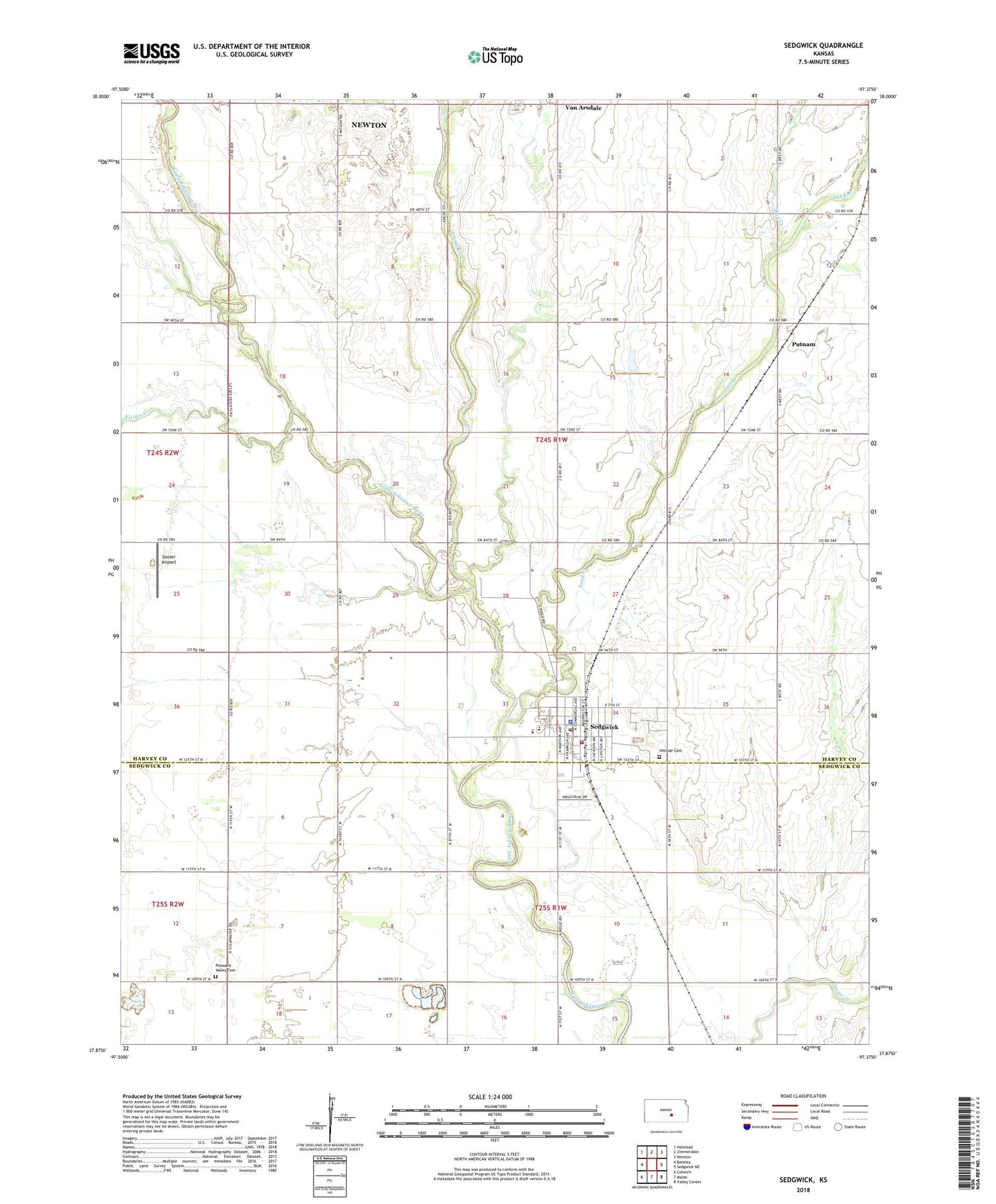
Sedgwick Kansas US Topo Map
Couldn't load pickup availability
2022 topographic map quadrangle Sedgwick in the state of Kansas. Scale: 1:24000. Based on the newly updated USGS 7.5' US Topo map series, this map is in the following counties: Harvey, Sedgwick. The map contains contour data, water features, and other items you are used to seeing on USGS maps, but also has updated roads and other features. This is the next generation of topographic maps. Printed on high-quality waterproof paper with UV fade-resistant inks.
Quads adjacent to this one:
West: Bentley
Northwest: Halstead
North: Zimmerdale
Northeast: Newton
East: Sedgwick NE
Southeast: Valley Center
South: Maize
Southwest: Colwich
This map covers the same area as the classic USGS quad with code o37097h4.
Contains the following named places: City of Sedgwick, City of Sedgwick Volunteer Ambulance Department, East Emma Creek, Emma Creek, First Christian Church, Halstead Wastewater Treatment Facility, Hillside Cemetery, Kisiwa Creek, Lillian Tear Library, McKinley Mobile Home Park, Mud Creek, Pleasant Valley Cemetery, Pleasant Valley Church, Plymouth Congregational Church, Putnam, R L Wright Elementary School, Sand Creek, Sedgwick, Sedgwick City Hall, Sedgwick Community Center, Sedgwick Elementary School, Sedgwick High School, Sedgwick Industrial Park, Sedgwick Police Department, Sedgwick Post Office, Sedgwick Recreation Center, Sedgwick Senior Center, Sedgwick United Methodist Church, Sedgwick Volunteer Fire Department, Sedgwick Wastewater Treatment Plant, Sooter Airport, Township of Sedgwick, Van Arsdale, West Emma Creek, ZIP Code: 67135