MyTopo
Colwich Kansas US Topo Map
Couldn't load pickup availability
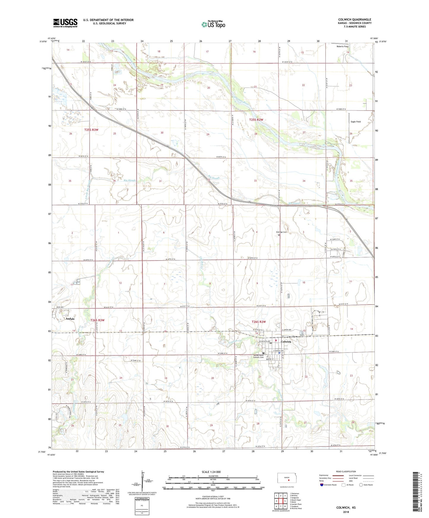
2022 topographic map quadrangle Colwich in the state of Kansas. Scale: 1:24000. Based on the newly updated USGS 7.5' US Topo map series, this map is in the following counties: Sedgwick. The map contains contour data, water features, and other items you are used to seeing on USGS maps, but also has updated roads and other features. This is the next generation of topographic maps. Printed on high-quality waterproof paper with UV fade-resistant inks.
Quads adjacent to this one:
West: Mount Hope
Northwest: Patterson
North: Bentley
Northeast: Sedgwick
East: Maize
Southeast: Wichita West
South: Goddard
Southwest: Garden Plain
This map covers the same area as the classic USGS quad with code o37097g5.
Contains the following named places: Andale Sewer Treatment Facility, City of Colwich, Colwich, Colwich Administrative Center, Colwich Community Library, Colwich Elementary School, Colwich Fire Department, Colwich Health Center Nursing Home, Colwich Industrial Park, Colwich Police Department, Colwich Post Office, Colwich Wastewater Treatment Facility, Eagle Field, Eldridge, Eldridge Cemetery, KAKE-TV (Wichita), KEYN-FM (Wichita), KFBZ - FM (Colwich), KGCS-FM (Wichita), KIBB - FM (Colwich), KKRD-FM (Wichita), KRBB - FM (Wichita), KSAS - TV (Wichita), KSNW-TV (Wichita), KTHR - FM (Wichita), KZSN - FM (Colwich), Roberts Field, Sacred Heart Catholic Cemetery, Sacred Heart Catholic Church, South Fork Big Slough, Township of Eagle, Township of Union, Williamsport, ZIP Code: 67030