MyTopo
McCracken Branch Kansas US Topo Map
Couldn't load pickup availability
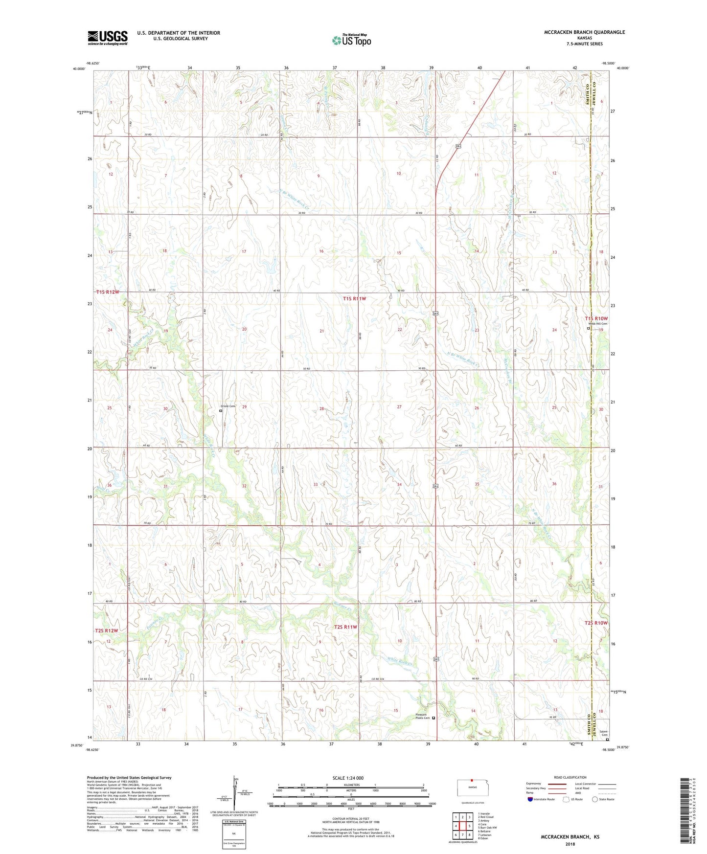
2022 topographic map quadrangle McCracken Branch in the state of Kansas. Scale: 1:24000. Based on the newly updated USGS 7.5' US Topo map series, this map is in the following counties: Smith, Jewell. The map contains contour data, water features, and other items you are used to seeing on USGS maps, but also has updated roads and other features. This is the next generation of topographic maps. Printed on high-quality waterproof paper with UV fade-resistant inks.
Quads adjacent to this one:
West: Cora
Northwest: Inavale
North: Red Cloud
Northeast: Amboy
East: Burr Oak NW
Southeast: Esbon
South: Lebanon
Southwest: Bellaire
This map covers the same area as the classic USGS quad with code o39098h5.
Contains the following named places: McCracken Branch, Mount Hope Church, Oriole Cemetery, Pawnee Creek, Pleasant Plains Cemetery, Salem, Salem Cemetery, Sherwood, Shute Airport, Township of Logan, Webb Hill Cemetery, Wolf Creek