MyTopo
Red Cloud Nebraska US Topo Map
Couldn't load pickup availability
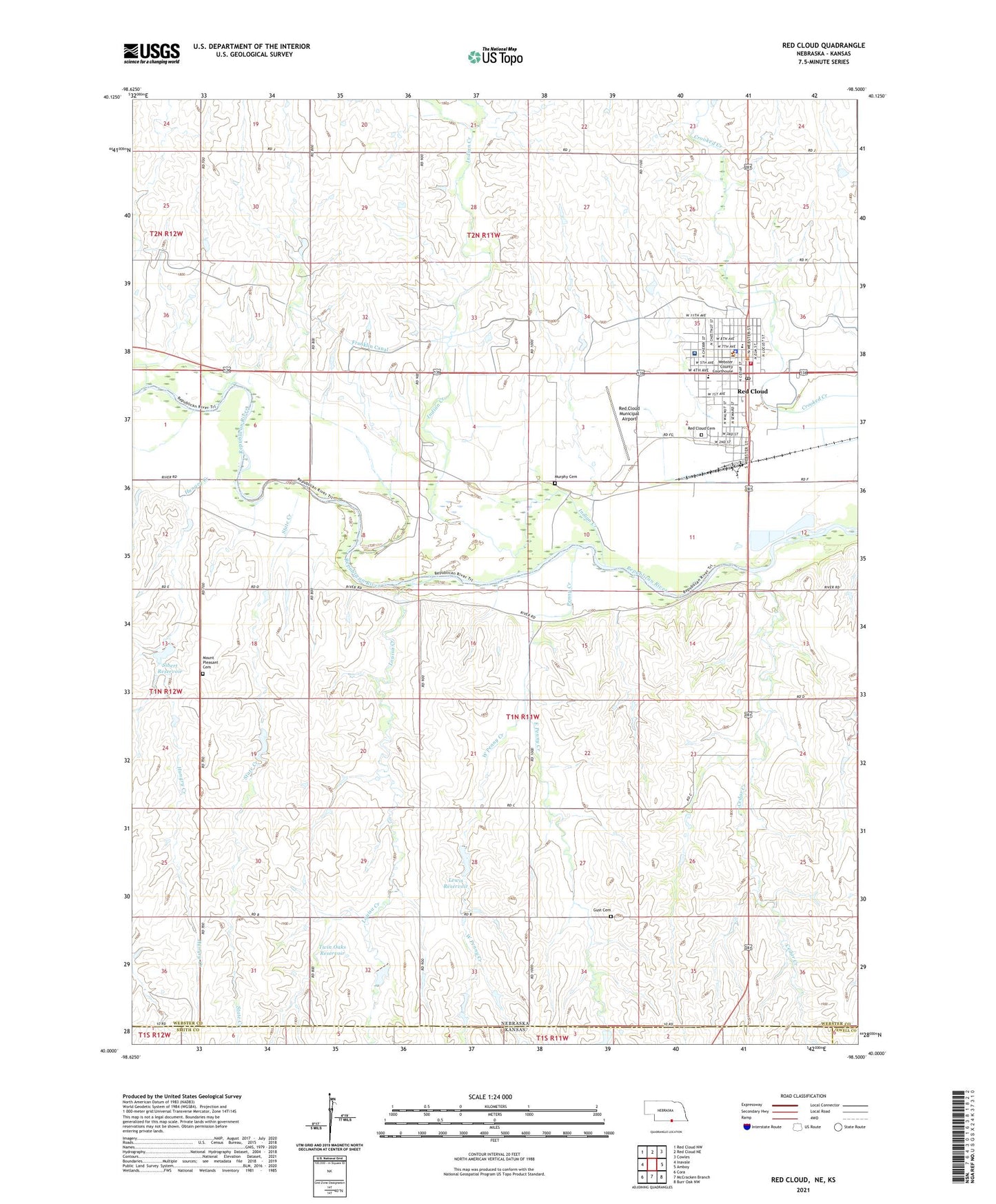
2021 topographic map quadrangle Red Cloud in the state of Nebraska. Scale: 1:24000. Based on the newly updated USGS 7.5' US Topo map series, this map is in the following counties: Webster, Smith, Jewell. The map contains contour data, water features, and other items you are used to seeing on USGS maps, but also has updated roads and other features. This is the next generation of topographic maps. Printed on high-quality waterproof paper with UV fade-resistant inks.
Quads adjacent to this one:
West: Inavale
Northwest: Red Cloud NW
North: Red Cloud NE
Northeast: Cowles
East: Amboy
Southeast: Burr Oak NW
South: McCracken Branch
Southwest: Cora
This map covers the same area as the classic USGS quad with code o40098a5.
Contains the following named places: Assembly of God Church, Auld Public Library, Bells Sleepy Valley Campground, Burlington Depot Historical Marker, Cather Childhood Home Historical Marker, Cedar Creek, City of Red Cloud, Congregational Church, East Penny Creek, Election District 5, Grace Episcopal Church Historical Marker, Gust Cemetery, Heritage Care Center, Hungry Creek, Indian Creek, Indian Creek State Wildlife Management Area, Lewis Dam, Lewis Reservoir, Louisa Creek, Main Street Clinic, Mount Pleasant Cemetery, Murphy Cemetery, Penny Creek, Red Cloud, Red Cloud Cemetery, Red Cloud City Park, Red Cloud Dental Clinic, Red Cloud Elementary School, Red Cloud High School, Red Cloud Historical Marker, Red Cloud Municipal Airport, Red Cloud Police Department, Red Cloud Post Office, Red Cloud Vision Clinic, Red Cloud Volunteer Fire and Rescue, Sacred Heart Catholic Church, Saint Juliana Falconieri Catholic Church Historical Marker, School Creek, Sibert Dam, Sibert Reservoir, Simag Grain Incorporated Elevator, State Creek, Twin Oaks Dam, Twin Oaks Reservoir, United Methodist Church, Webster County Chiropractic Clinic, Webster County Clinic, Webster County Community Hospital, Webster County Courthouse, Webster County Dental Clinic, Webster County Historical Marker, Webster County Historical Museum, Webster County Sheriff's Office, Wesleyan Church, West Penny Creek, Willa Cather Memorial Prairie Historical Marker, Willa Cather State Historic Site, Zion Lutheran Church, ZIP Code: 68970