MyTopo
Munden Kansas US Topo Map
Couldn't load pickup availability
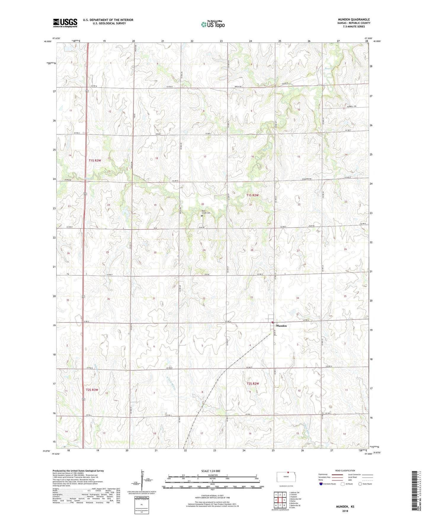
2022 topographic map quadrangle Munden in the state of Kansas. Scale: 1:24000. Based on the newly updated USGS 7.5' US Topo map series, this map is in the following counties: Republic. The map contains contour data, water features, and other items you are used to seeing on USGS maps, but also has updated roads and other features. This is the next generation of topographic maps. Printed on high-quality waterproof paper with UV fade-resistant inks.
Quads adjacent to this one:
West: Belleville NW
Northwest: Hebron SW
North: Chester
Northeast: Hubbell
East: Narka
Southeast: Cuba
South: Belleville SE
Southwest: Belleville
This map covers the same area as the classic USGS quad with code o39097h5.
Contains the following named places: City of Munden, Munden, Munden Post Office, Munden Wastewater Treatment Facility, Republic County District 3 Munden Volunteer Fire Department, Rose Creek Cemetery, Township of Rose Creek, ZIP Code: 66959