MyTopo
Wheaton Kansas US Topo Map
Couldn't load pickup availability
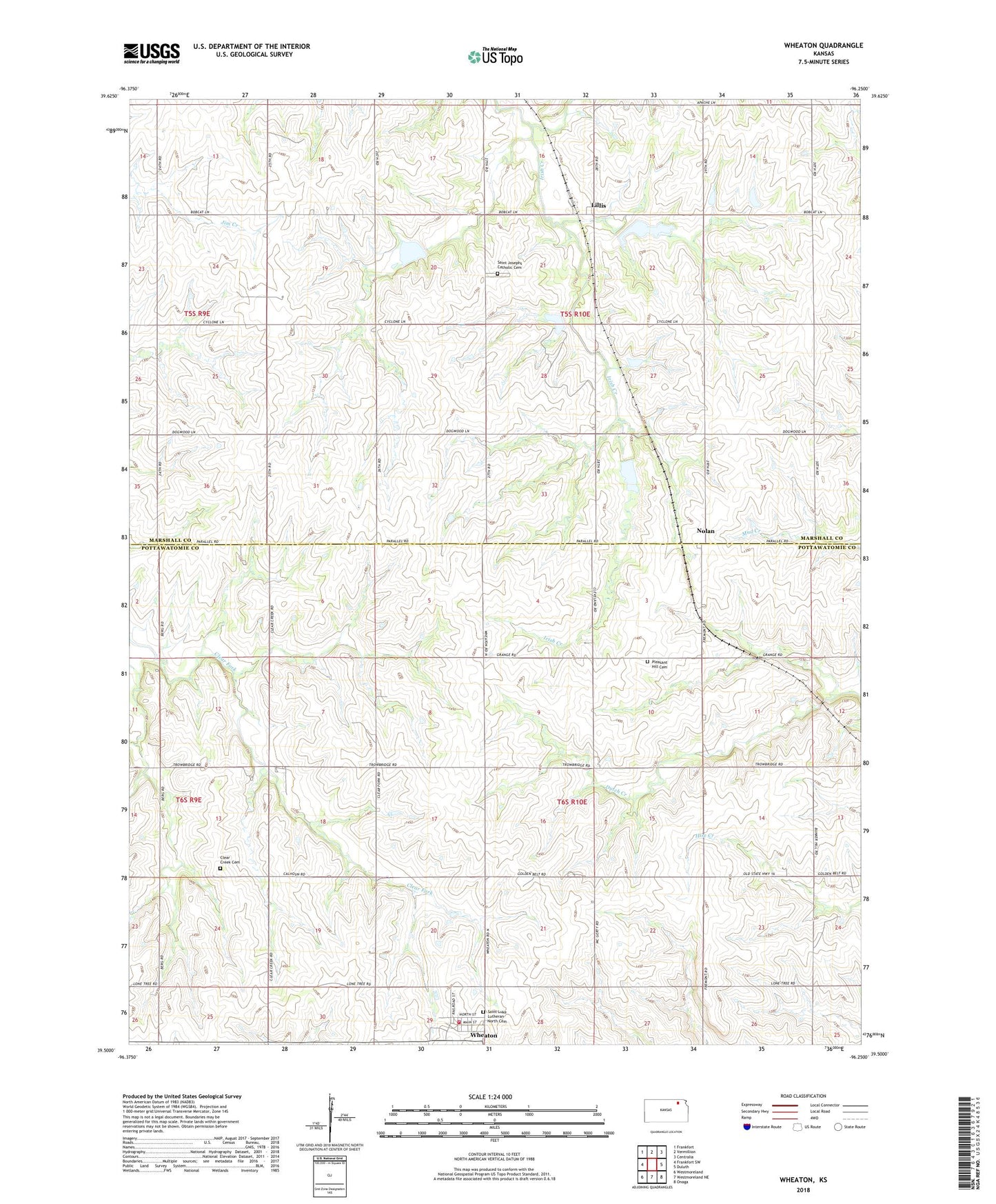
2022 topographic map quadrangle Wheaton in the state of Kansas. Scale: 1:24000. Based on the newly updated USGS 7.5' US Topo map series, this map is in the following counties: Marshall, Pottawatomie. The map contains contour data, water features, and other items you are used to seeing on USGS maps, but also has updated roads and other features. This is the next generation of topographic maps. Printed on high-quality waterproof paper with UV fade-resistant inks.
Quads adjacent to this one:
West: Frankfort SW
Northwest: Frankfort
North: Vermillion
Northeast: Centralia
East: Duluth
Southeast: Onaga
South: Westmoreland NE
Southwest: Westmoreland
This map covers the same area as the classic USGS quad with code o39096e3.
Contains the following named places: City of Wheaton, Clear Creek Cemetery, Lillis, Nolan, Pavilion, Pleasant Hill Cemetery, Pottawatomie County Fire District 4 Wheaton, Saint Josephs Catholic Cemetery, Saint Josephs Church, Saint Luke Lutheran Church, Saint Luke Lutheran North Cemetery, Township of Cleveland, Township of Lone Tree, Wheaton, Wheaton Elementary School, Wheaton Wastewater Plant, Wyoming